Bluff Creek West

Thanks again for coming to visit me at The Springs!

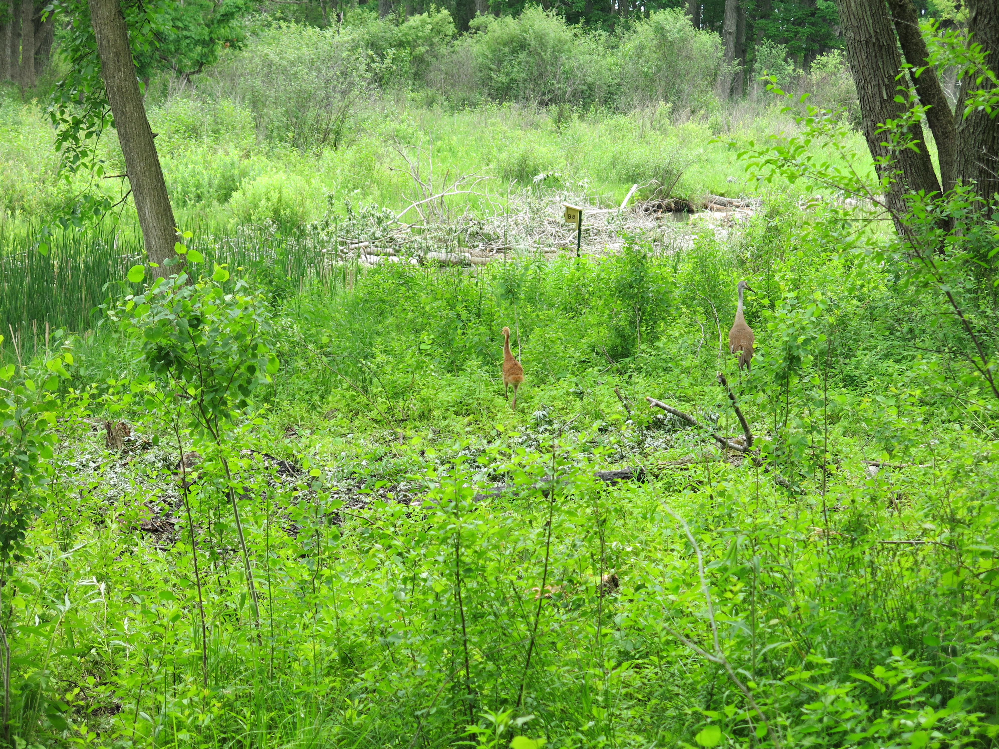
The Sand Hill Cranes are back and I’m wondering if we have opened up enough new habitat for a second family to take up residence in the area.  It has been an exceptional winter season for cutting buckthorn and, thanks to the Kettle Moraine Natural History Association funding the efforts of Chris Mann and the Kettle Moraine Land Stewards, LLC, we have opened up many acres of wetlands.

Prime real estate is available for ducks as well and on April 2, Brian Glenzinski, former DNR Wildlife Biologist now working with Ducks Unlimited, will be joining me to tour The Spings. You might recall that Brian is the artist who carved The Acorn given out by the Oak Savanna Alliance for their Land Steward of the Year award.  We plan to list with Brian and he was very positive about building some new “upscale” duck homes in the neighborhood.

By the way, don’t miss the Oak Savanna Alliance workshop on May 16th.  Contact Eric Tarman-Ramcheck (TR Natural Enterprises, LLC) for details and be sure to let him know who you think deserves The Acorn this time.

The highlight of the last two weeks was the morning I spent with the Southern Kettle Moraine SNA Volunteers at the Bluff Creek West State Natural Area, just south and east of Whitewater, WI.

BluffCreekWest

For sanity’s sake though, I’m going to recollect the events of the past few weeks in chronological order.

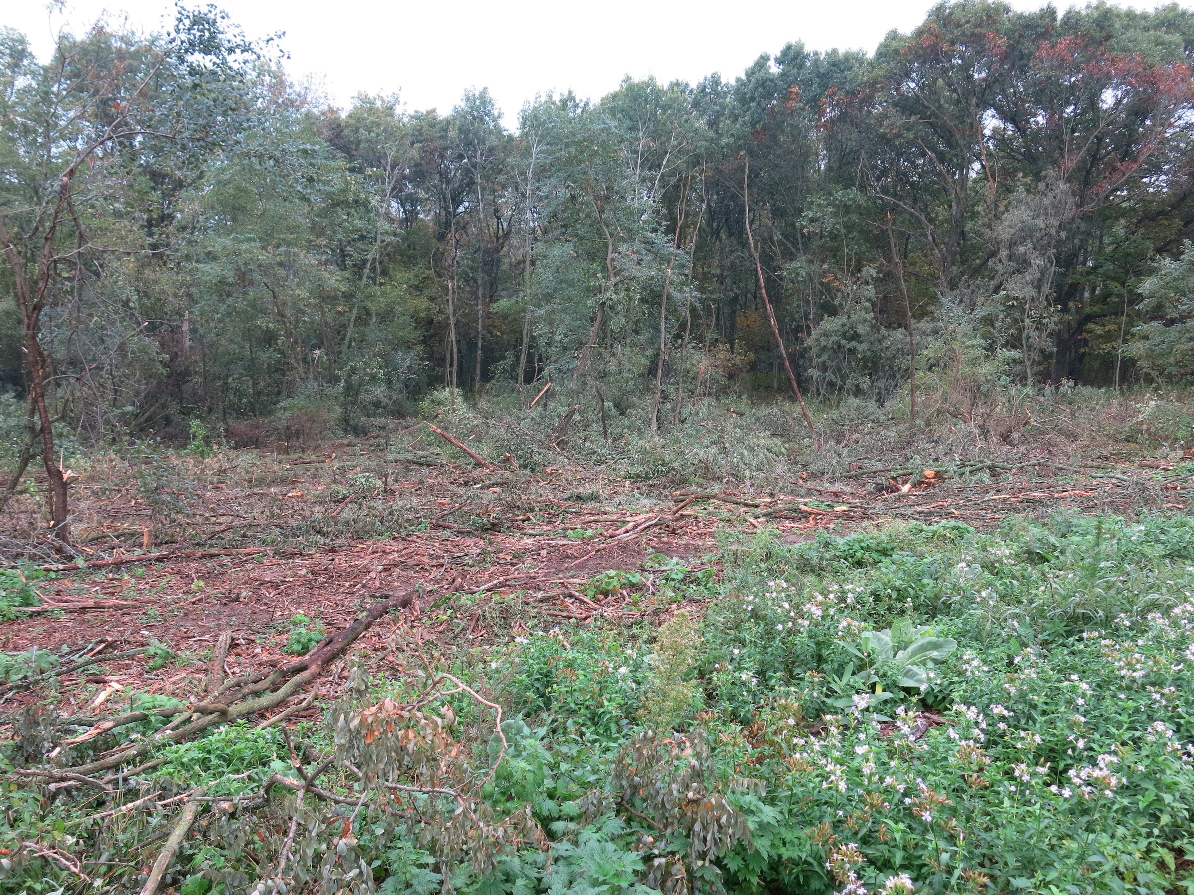
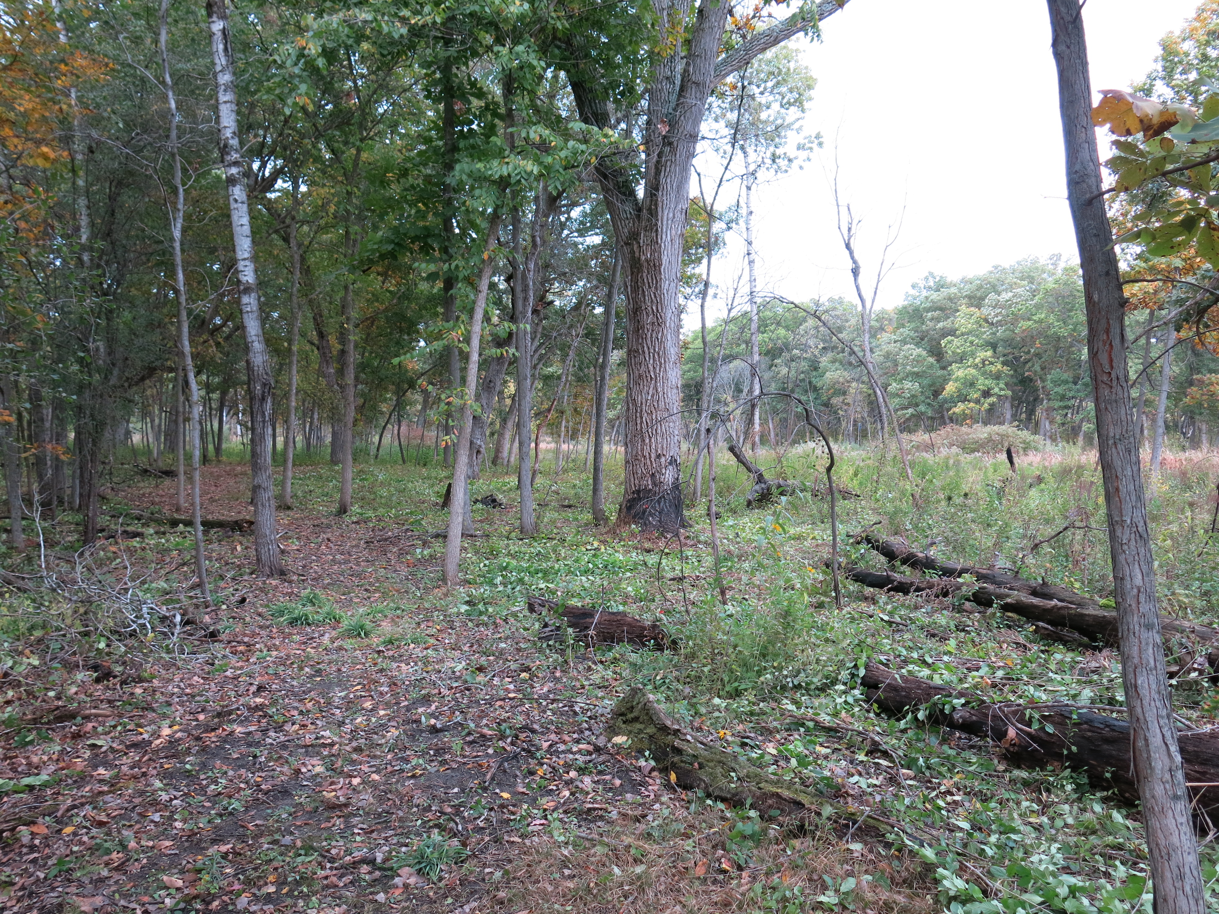
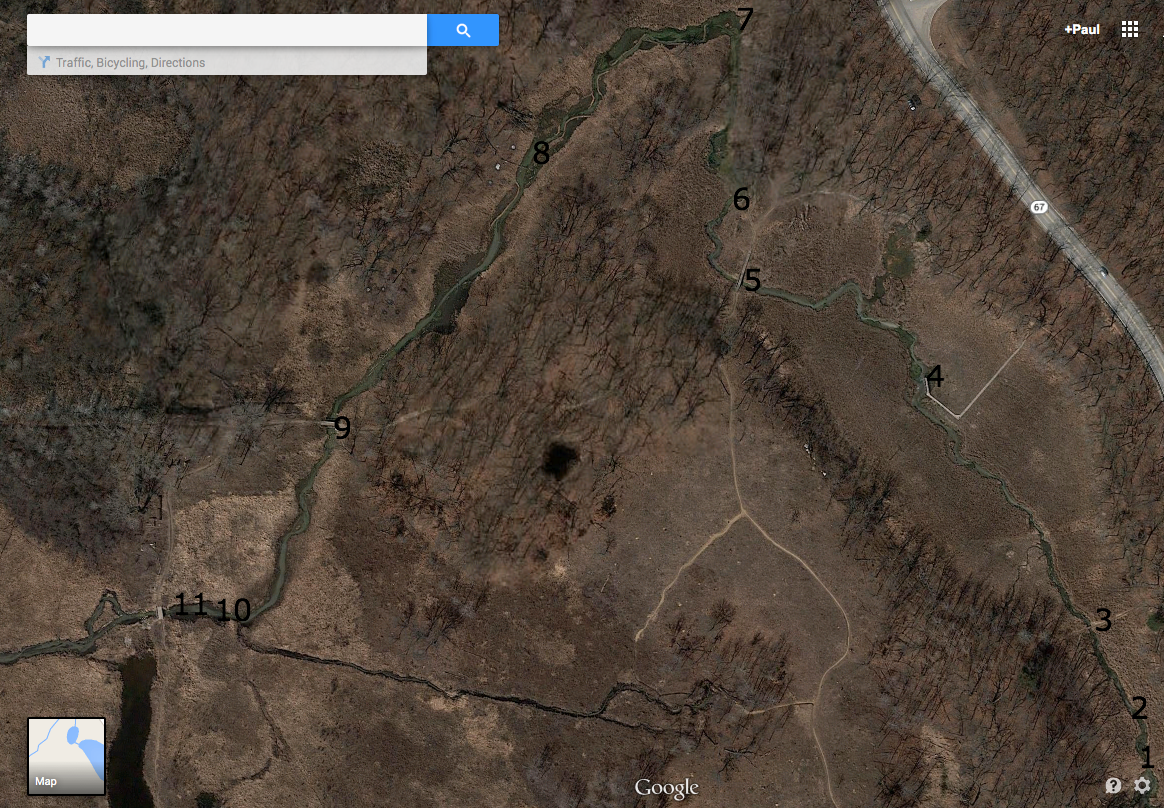
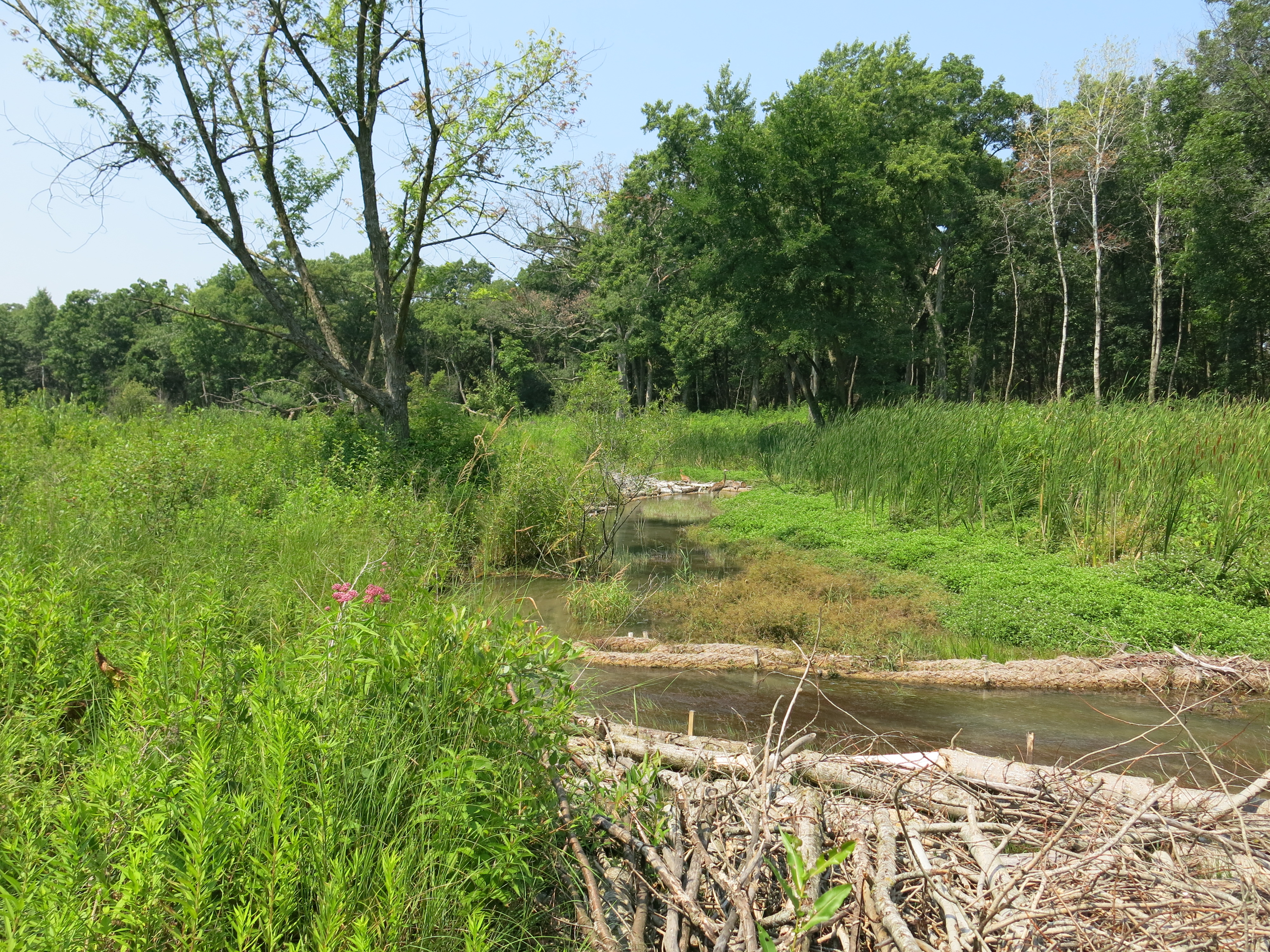
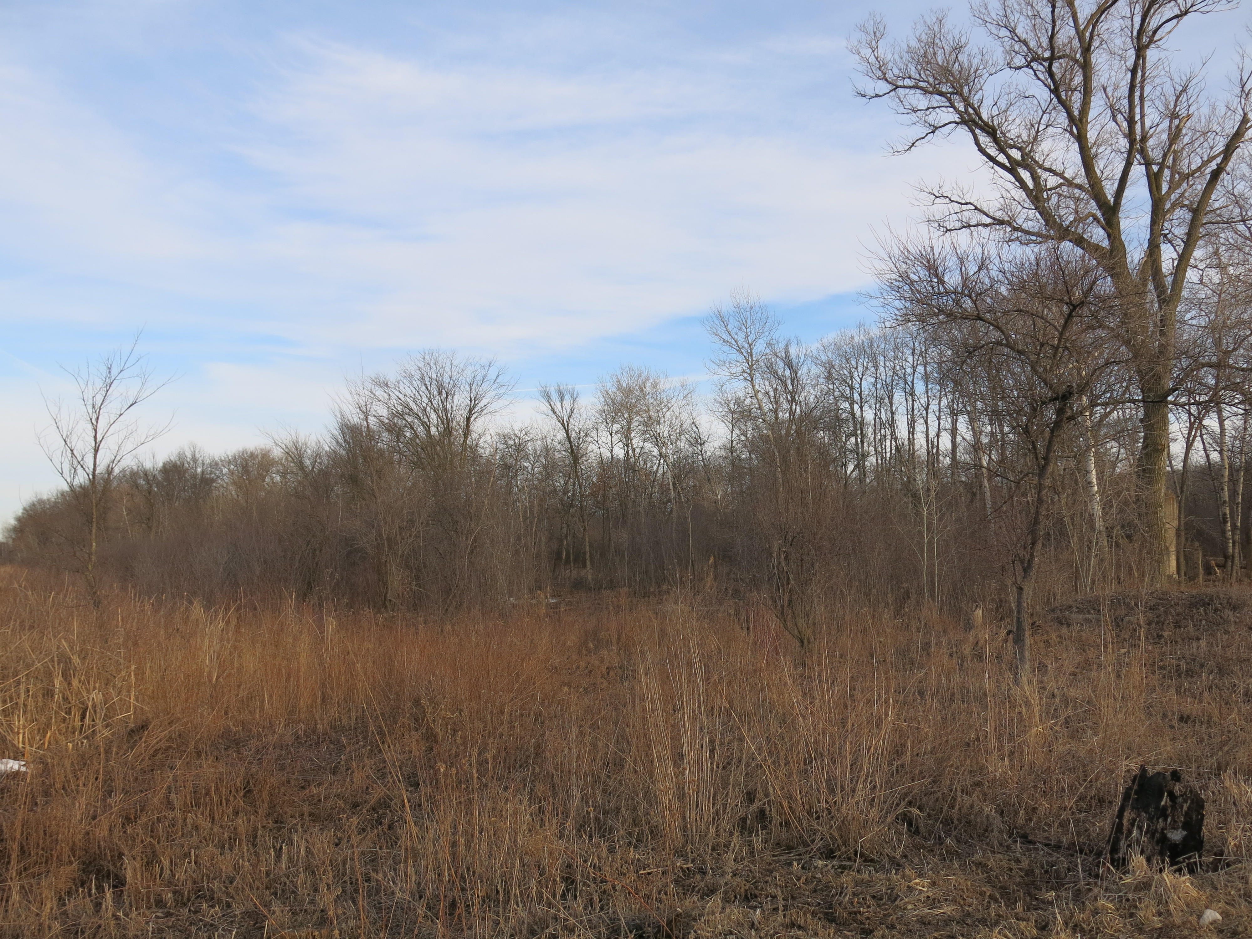
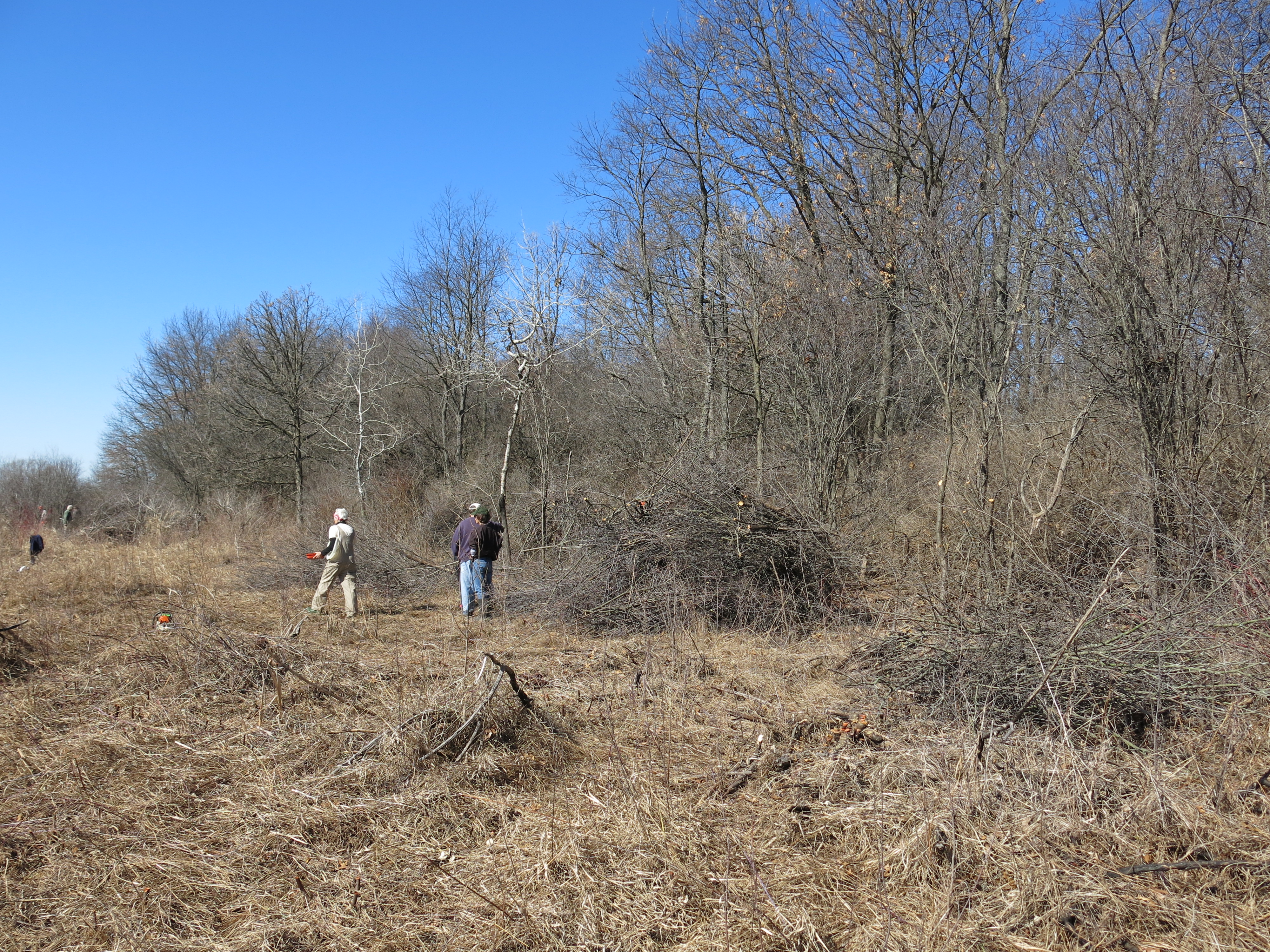
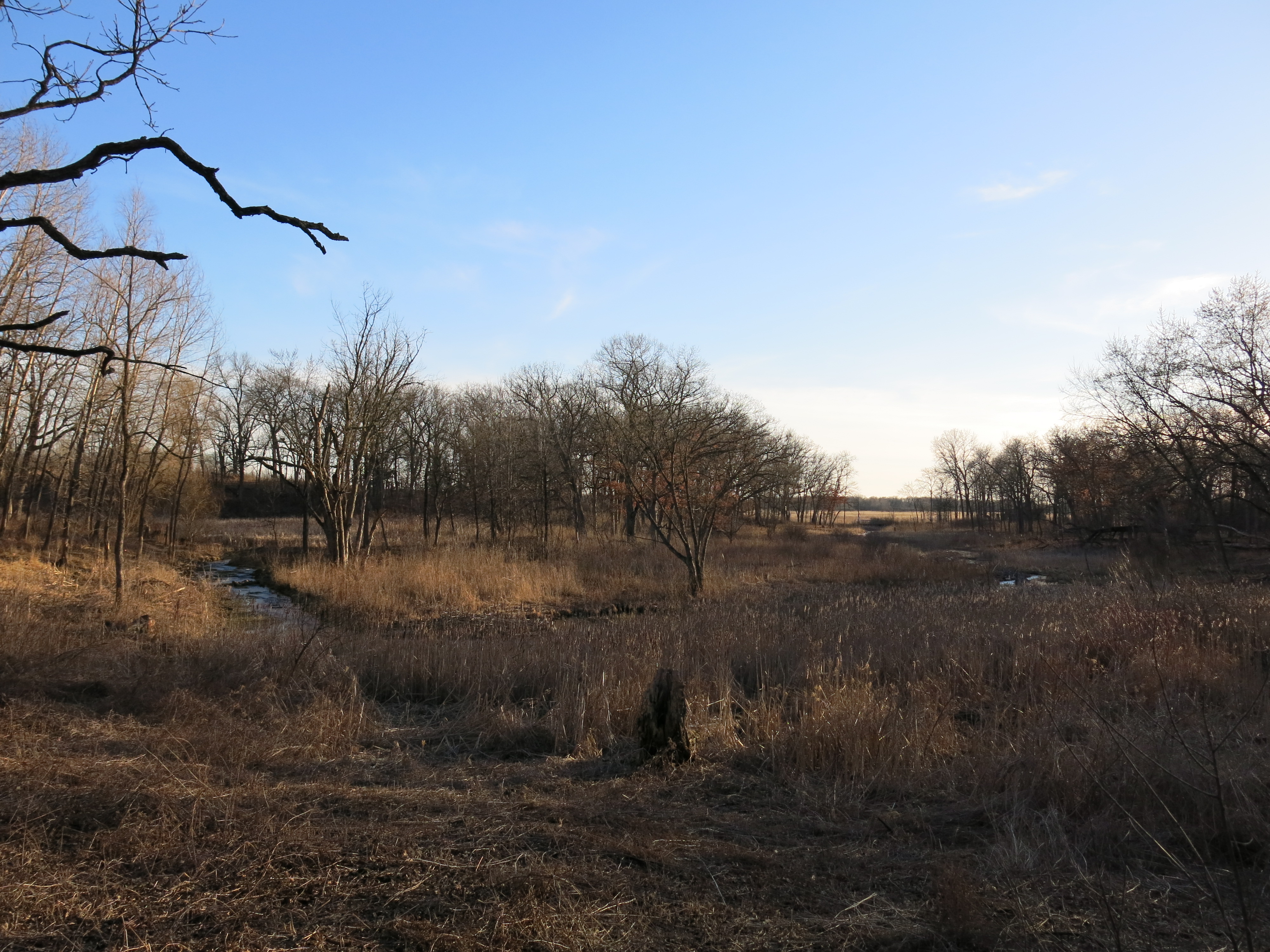
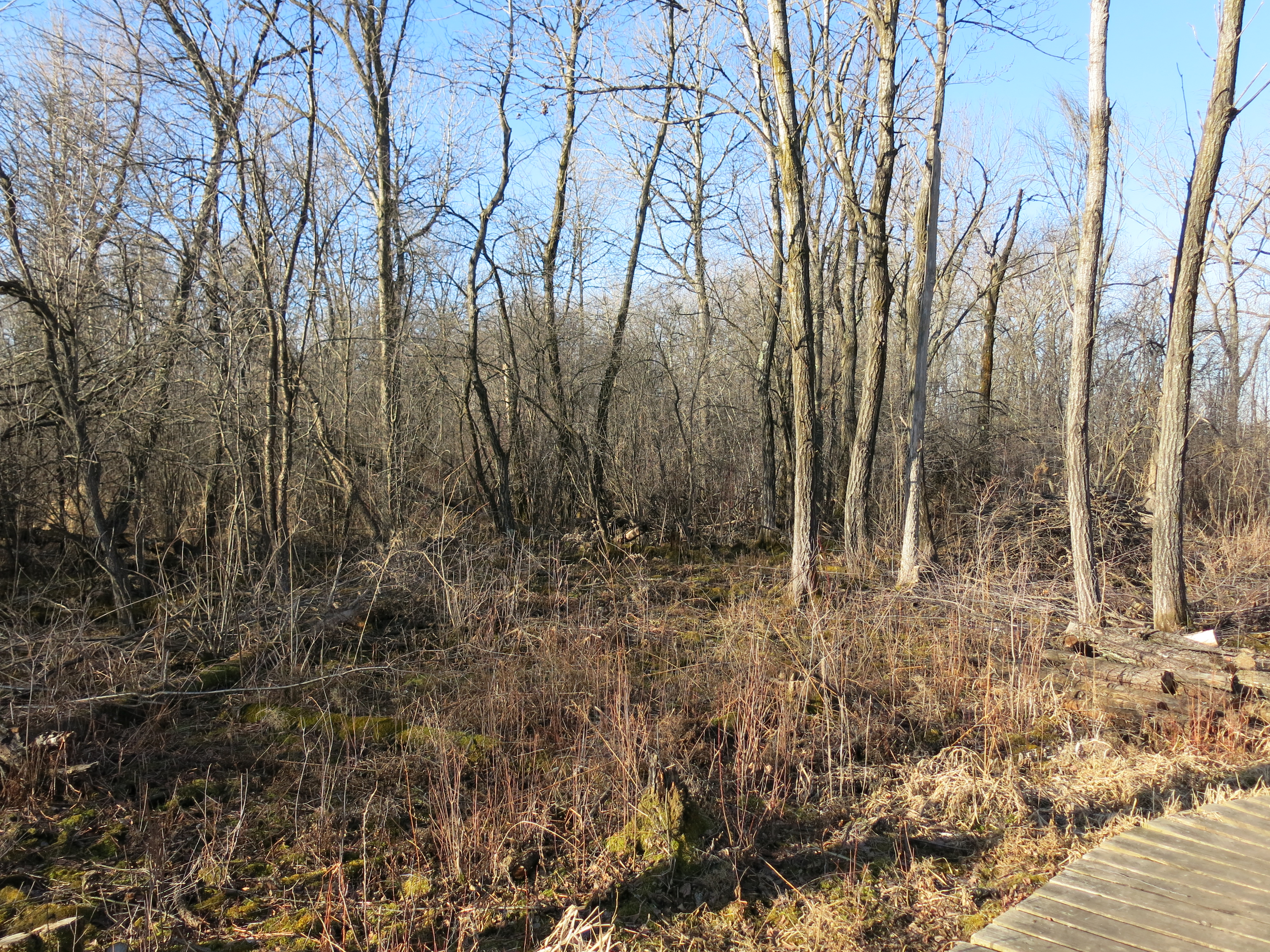
After weeks of cramming to prepare my defense against the band of thieves and robbers known as government, for my “day in court”, I needed a day in the woods with my chainsaw to settle my nerves.  I returned to the marl factory on March 12th to attack the last stand of buckthorn on the wedge of land between the Tibby Line railroad tracks (signpost #2) and Marl Pit Bridge (signpost #4).  Below, the area as seen from signpost #4.

IMG_5222

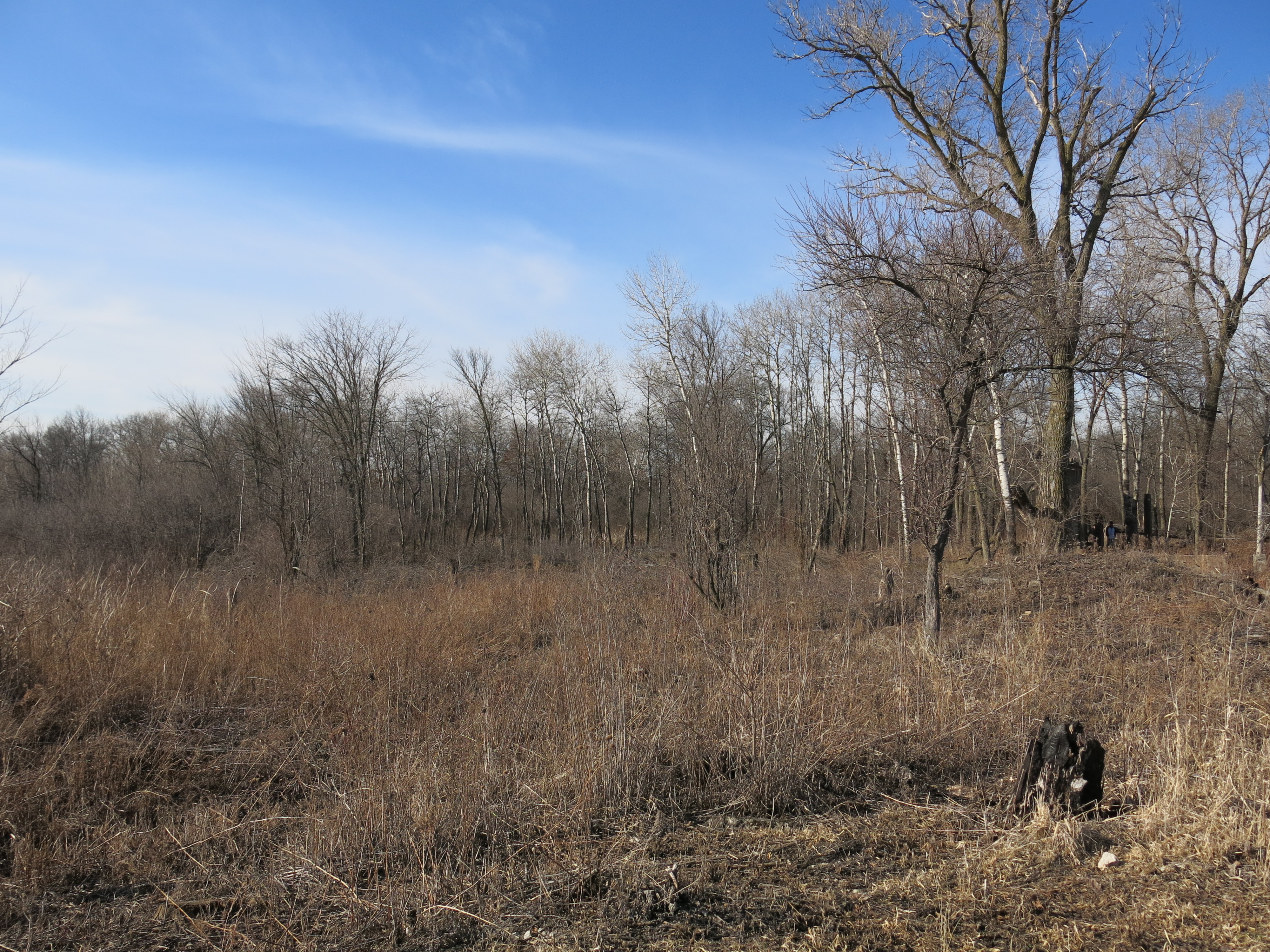
Now, imagine you just stepped forward to the treeline shown above and looked right, straight ahead and left.

IMG_5223 IMG_5225 IMG_5224

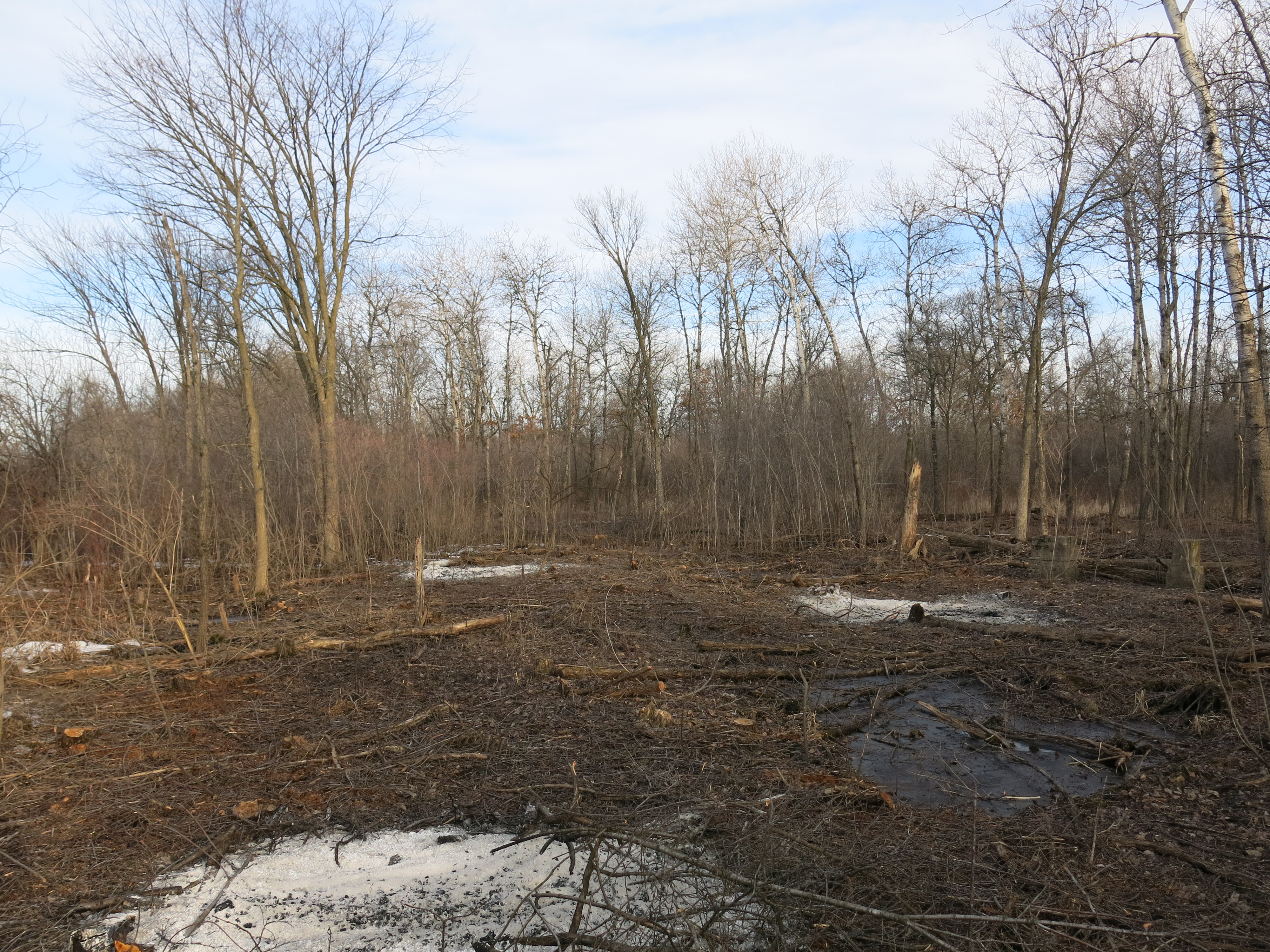
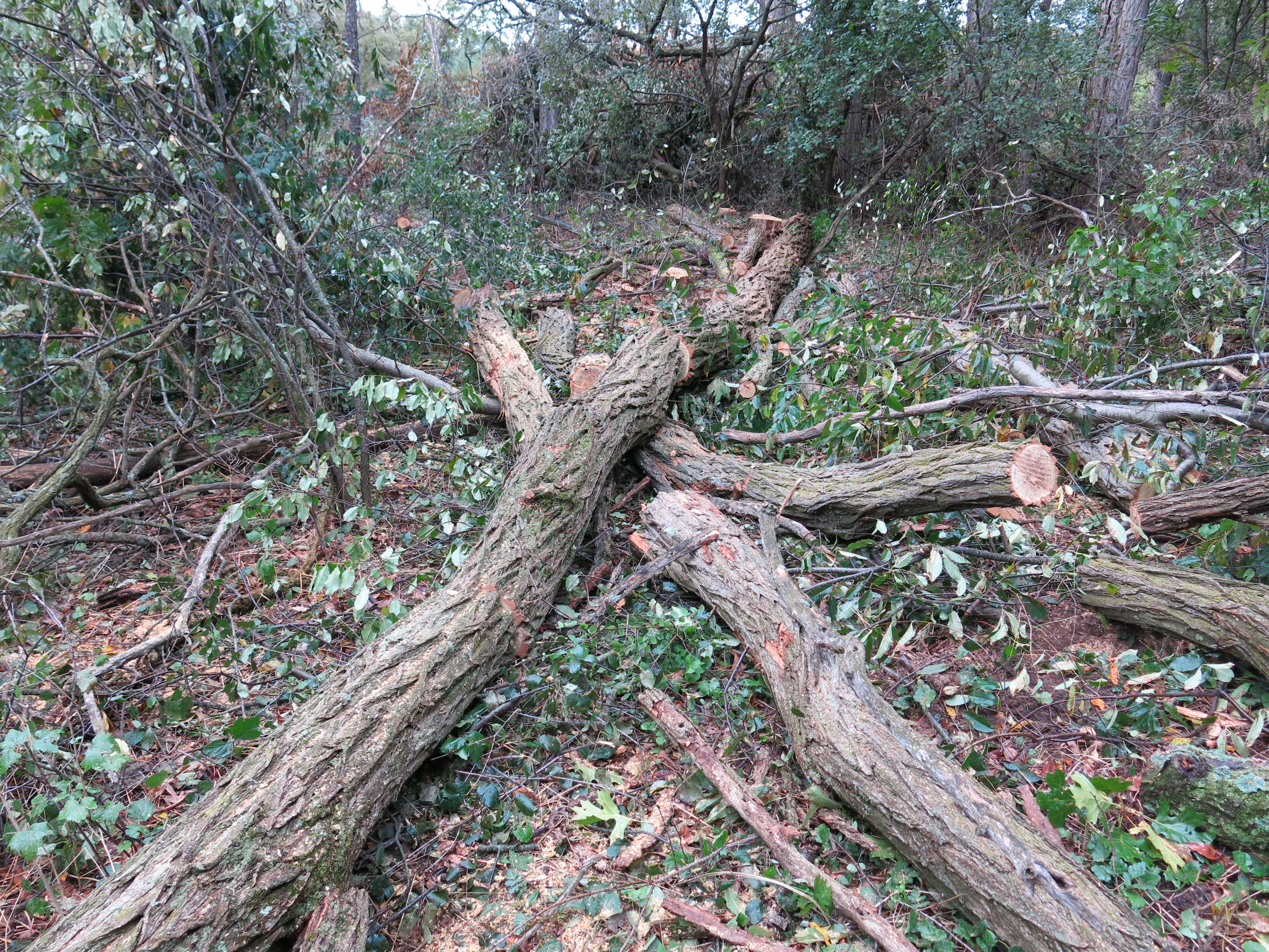
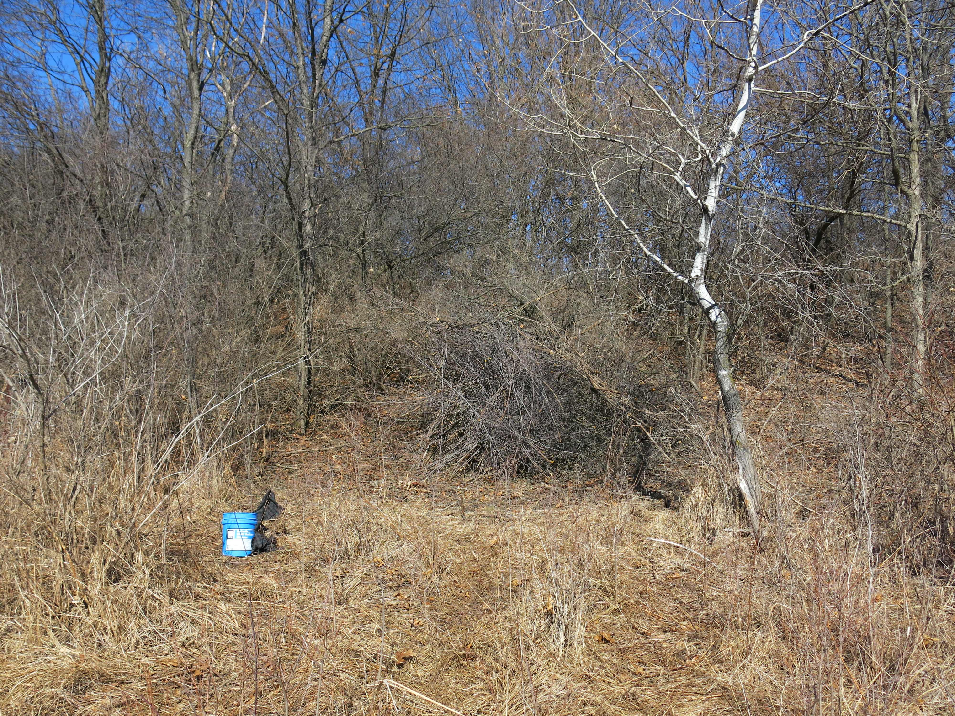
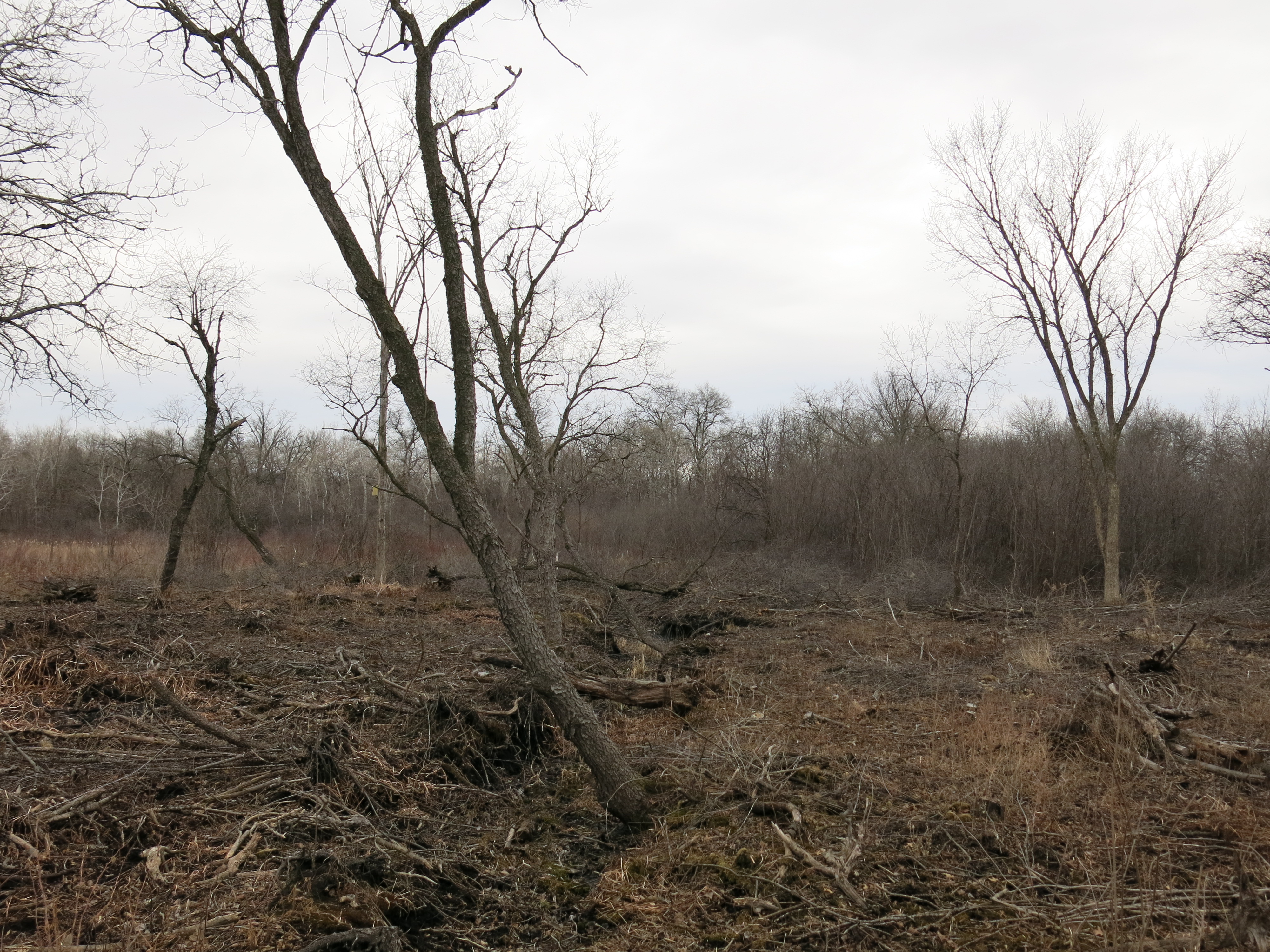
We carved a hole in the middle of this buckthorn thicket and now was the time to finish the perimeter.  I had a fine day cutting and stopped early to help my friend Scott, and his buddy Mr. Schnuddles, collect some firewood.

IMG_4017

IMG_5227 IMG_5230 IMG_5232 IMG_5233 IMG_5234

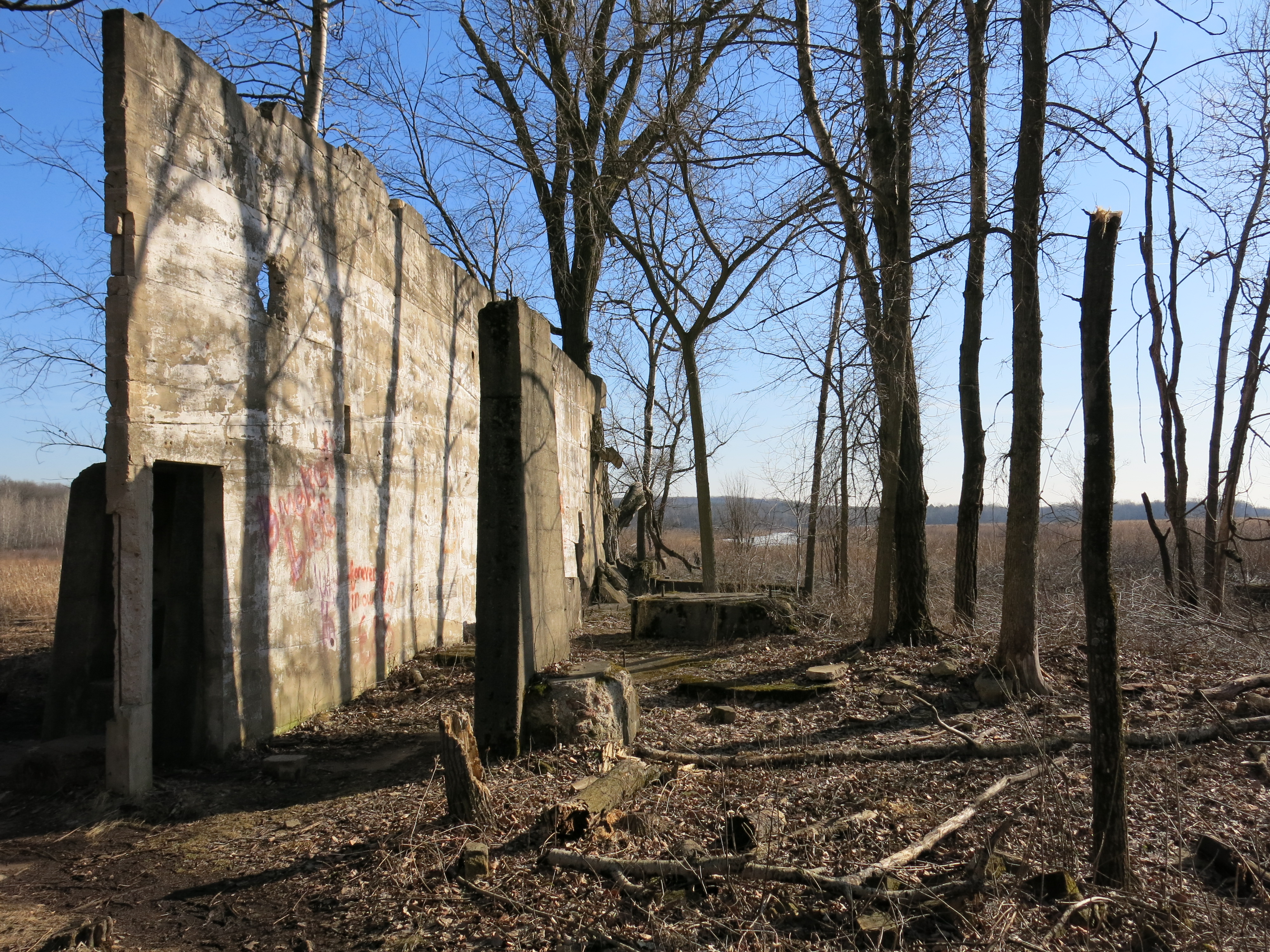
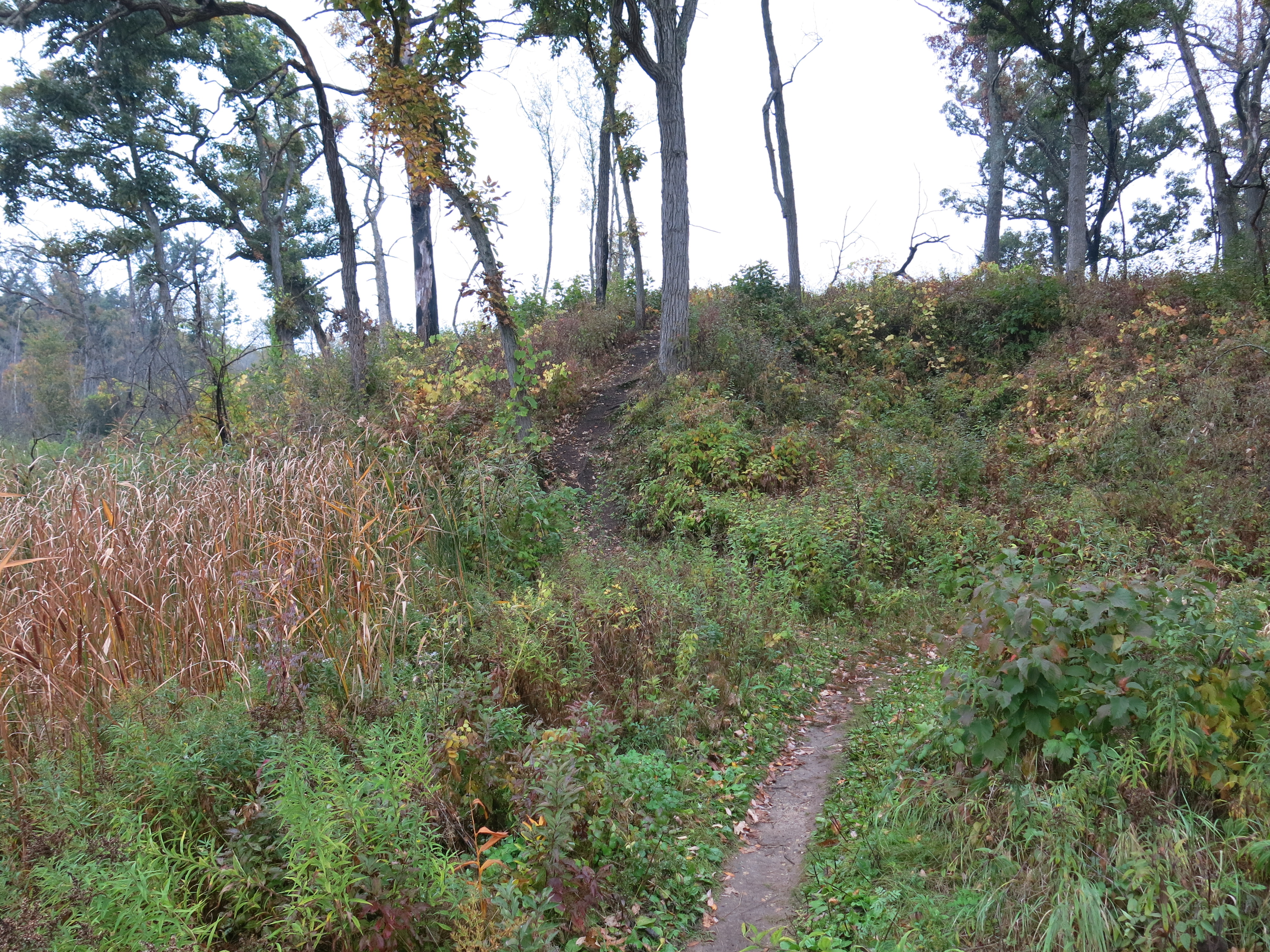
The view from signpost #4.

IMG_5235

I love to take a walk around The Springs at the end of a hard day’s work!

IMG_5238 IMG_5239

Hmmmm, why is that monster parked in the DNR lot above the Hotel Springs?

IMG_5240

The bubbler at the Emerald Springs was especially active.

IMG_5242

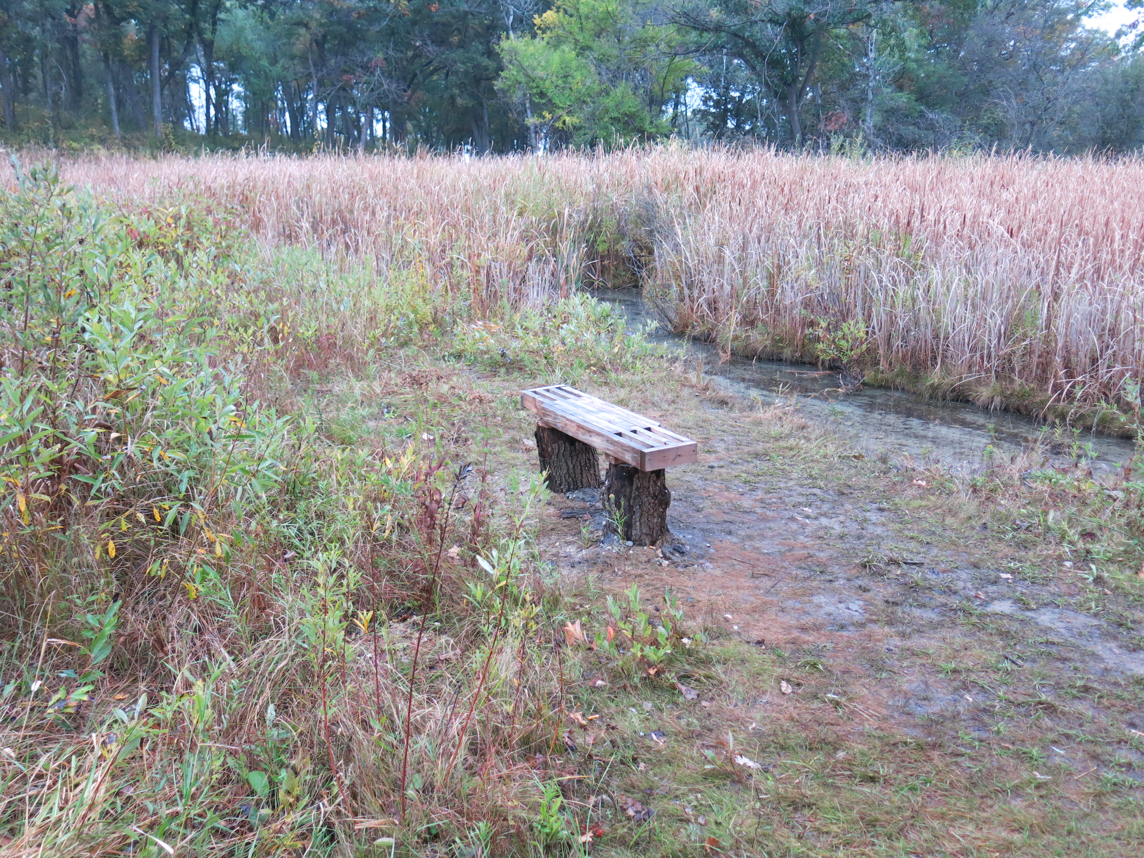
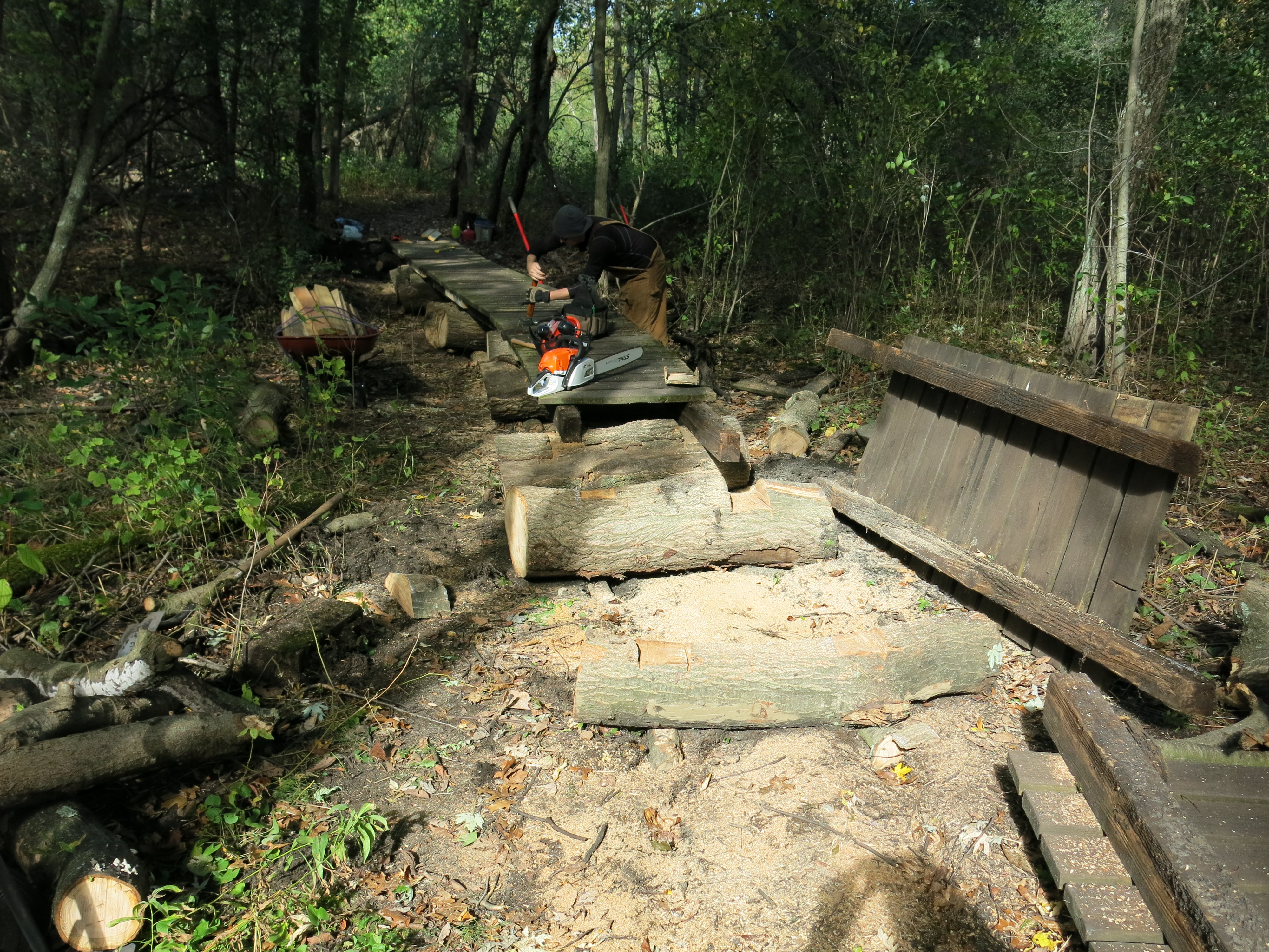
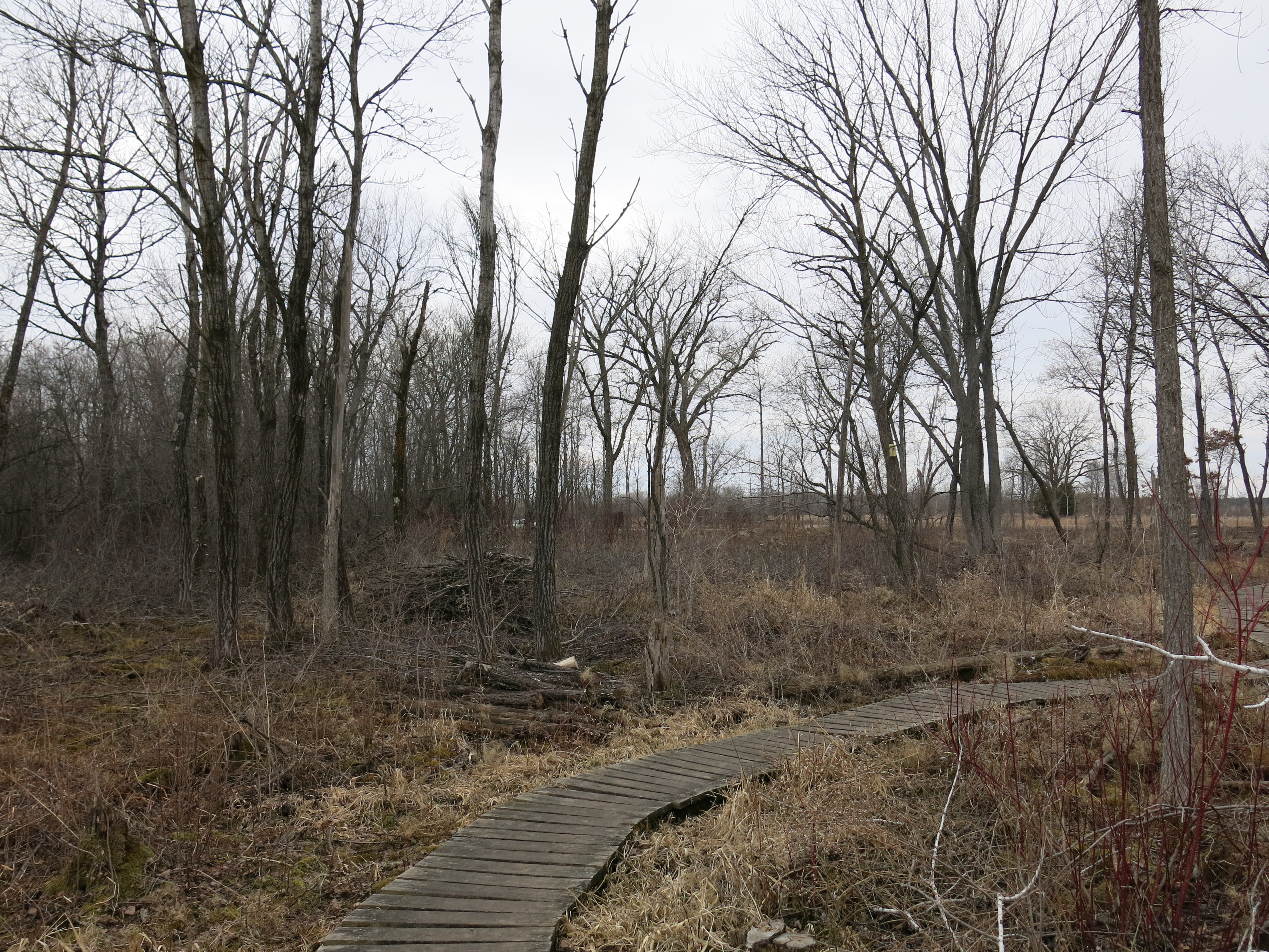
Ben, dude, we need to build a bridge here man!

IMG_1760

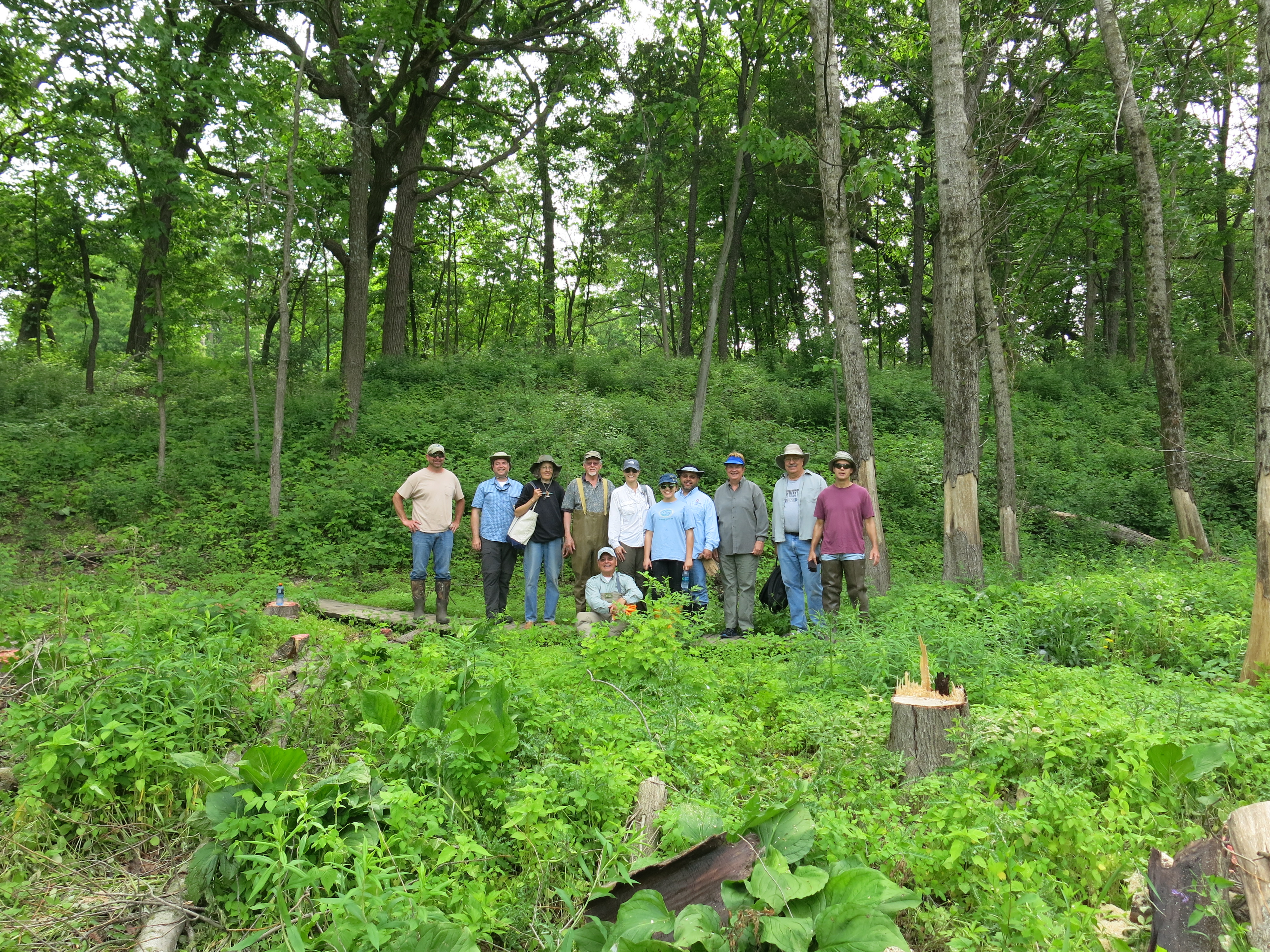
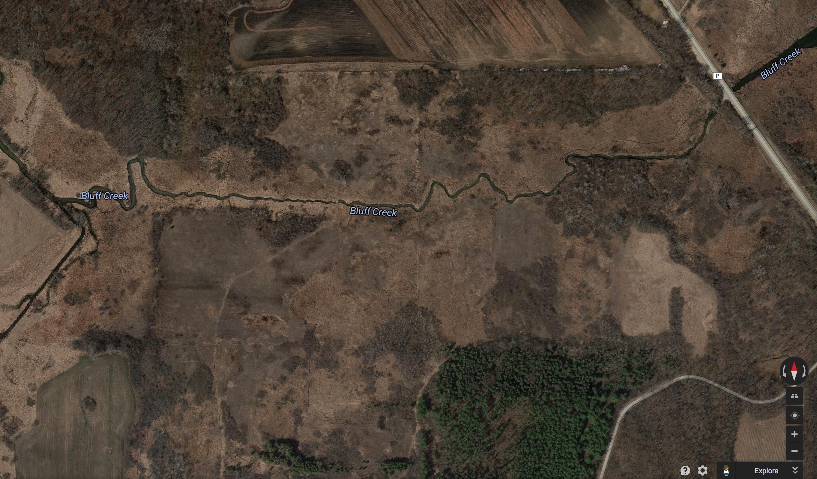
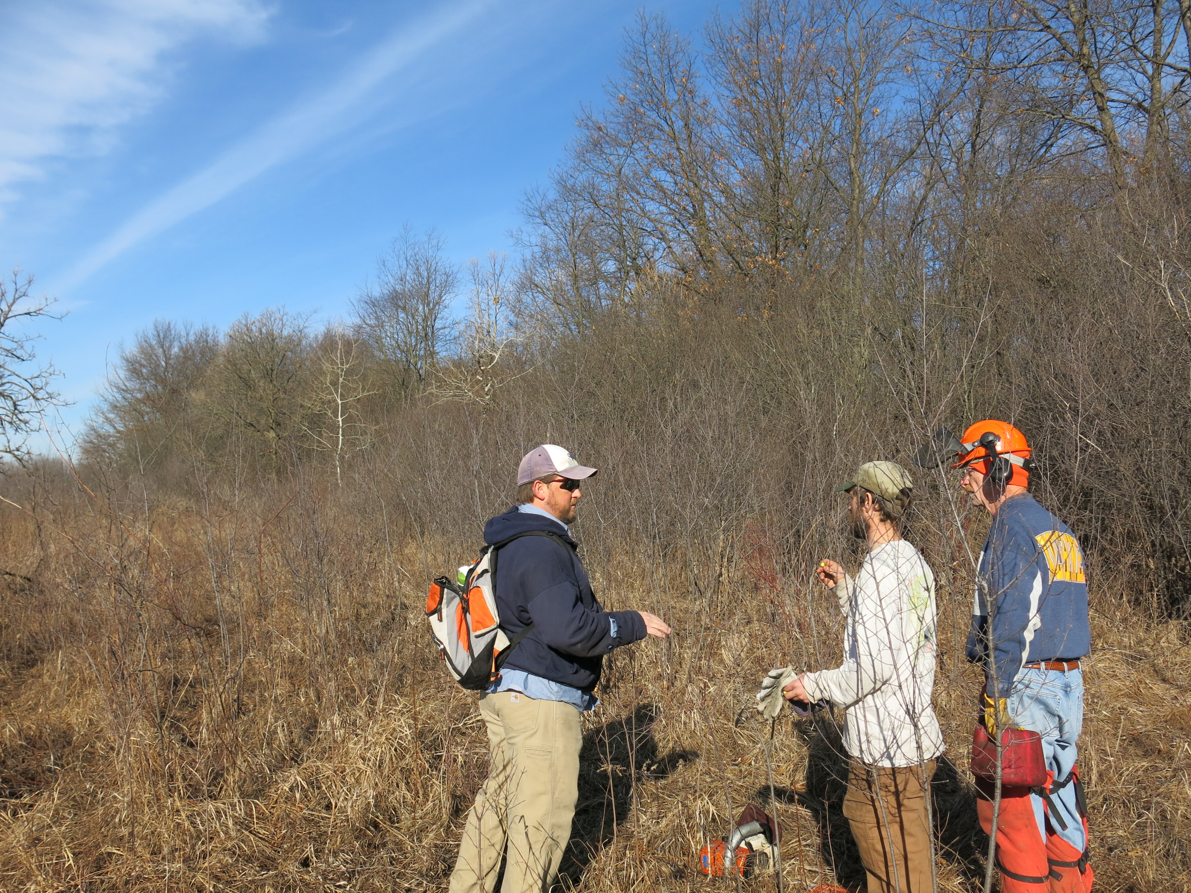
On Saturday, March 14th I joined Zach Kastern, Ginny Coburn, Jared Urban, and a great crew of SNA volunteers clearing buckthorn from the transition zone between the calcareous fen and the oak uplands at Bluff Creek West.  The area we worked is at the base of the forested ridge shown in the upper right hand corner of the Bluff Creek Prescribed Burn plan shown below.

bc burn aerial 08

Zach and Jared introduced the agenda for the day…

IMG_5266

… and we got after it!

IMG_5269 IMG_5270 IMG_5271 IMG_5273 IMG_5274 IMG_5275 IMG_5278 IMG_5280 IMG_5281 IMG_5282 IMG_5283

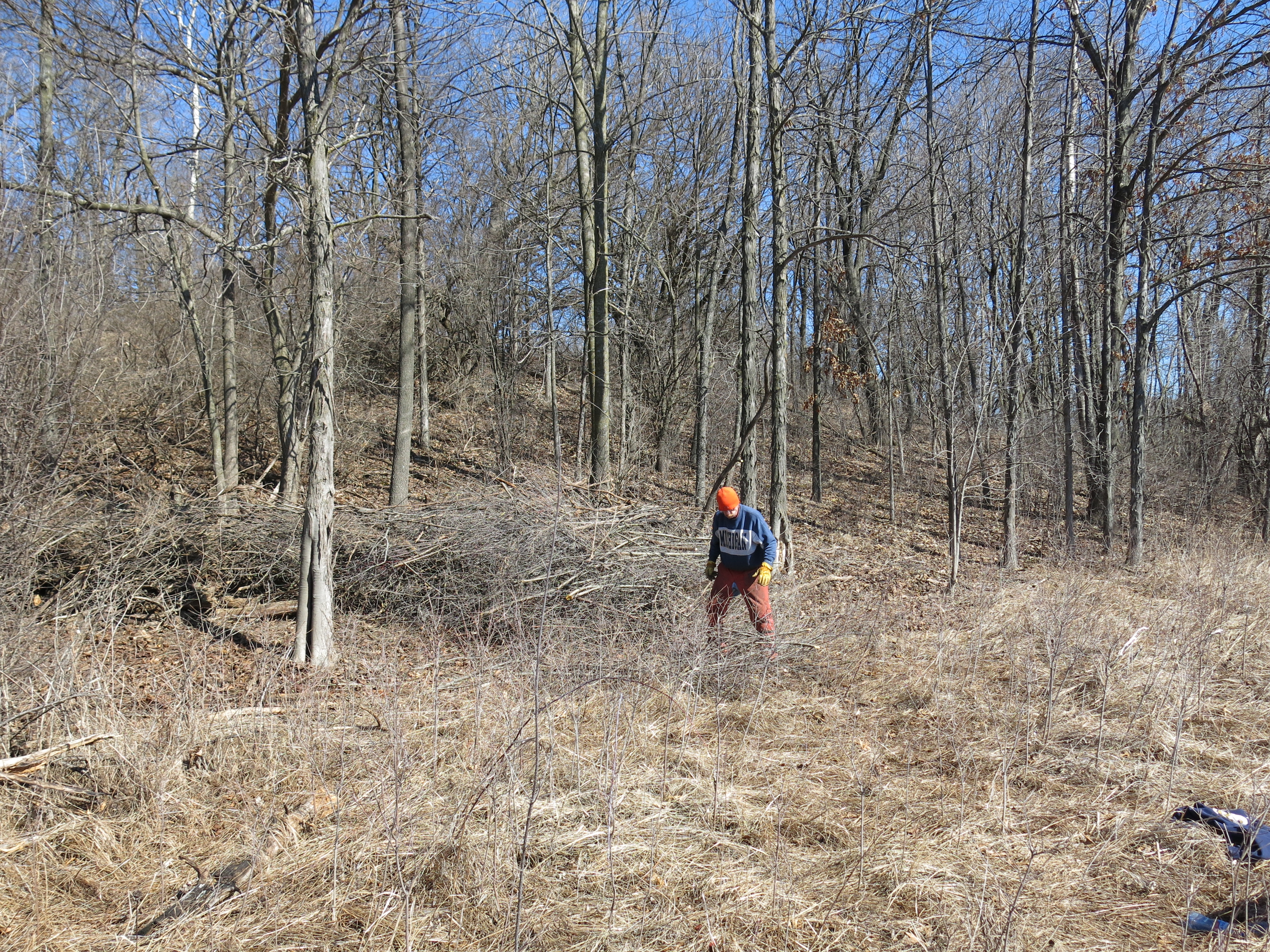
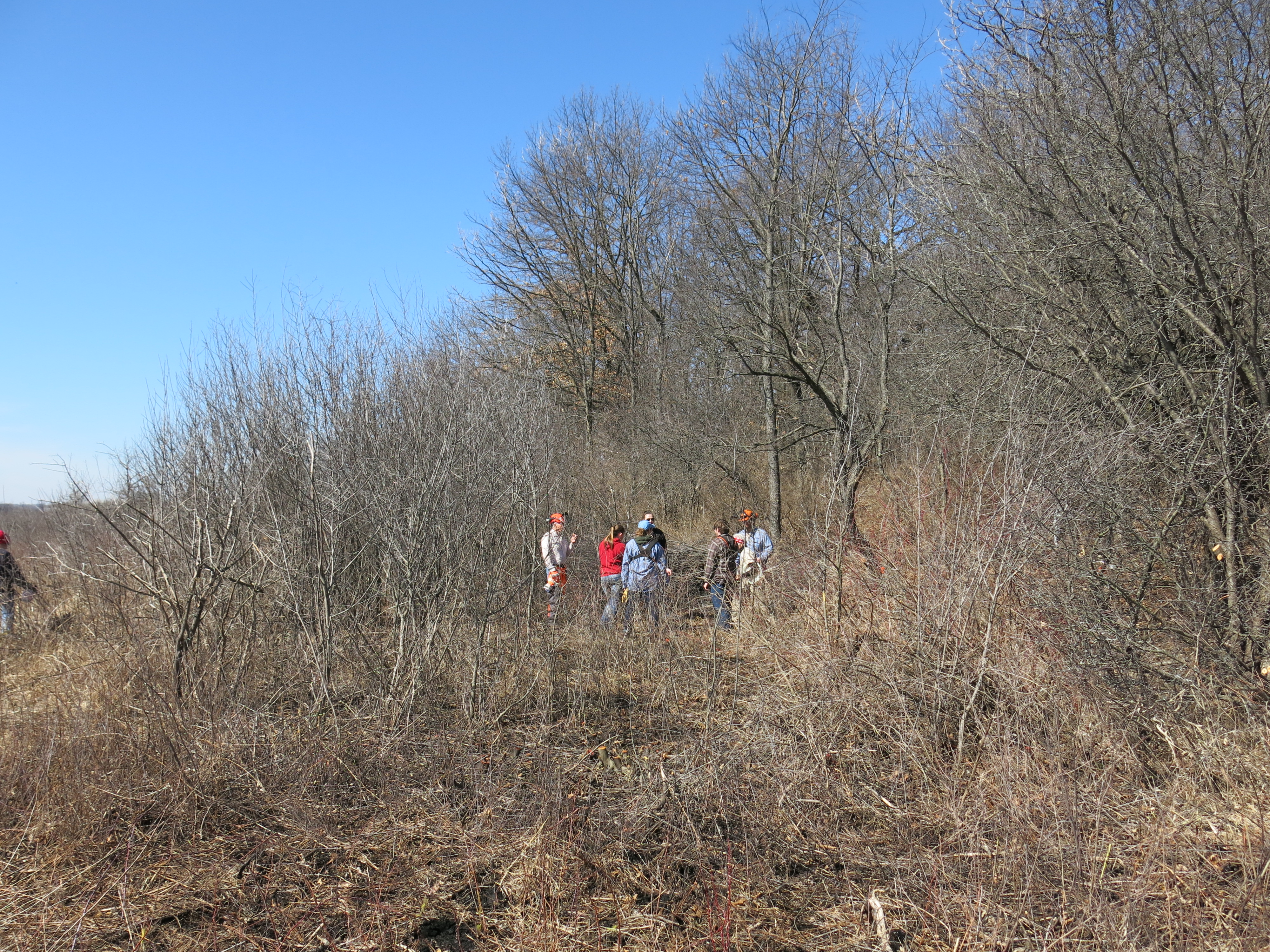
We made tremendous progress thanks to volunteers like this team from the University of Wisconsin-Whitewater Ecology Club.

IMG_5284

I got a chance to talk to Zach Kastern about the project.

I really enjoy these events and you might like it too!

IMG_5288 IMG_5291

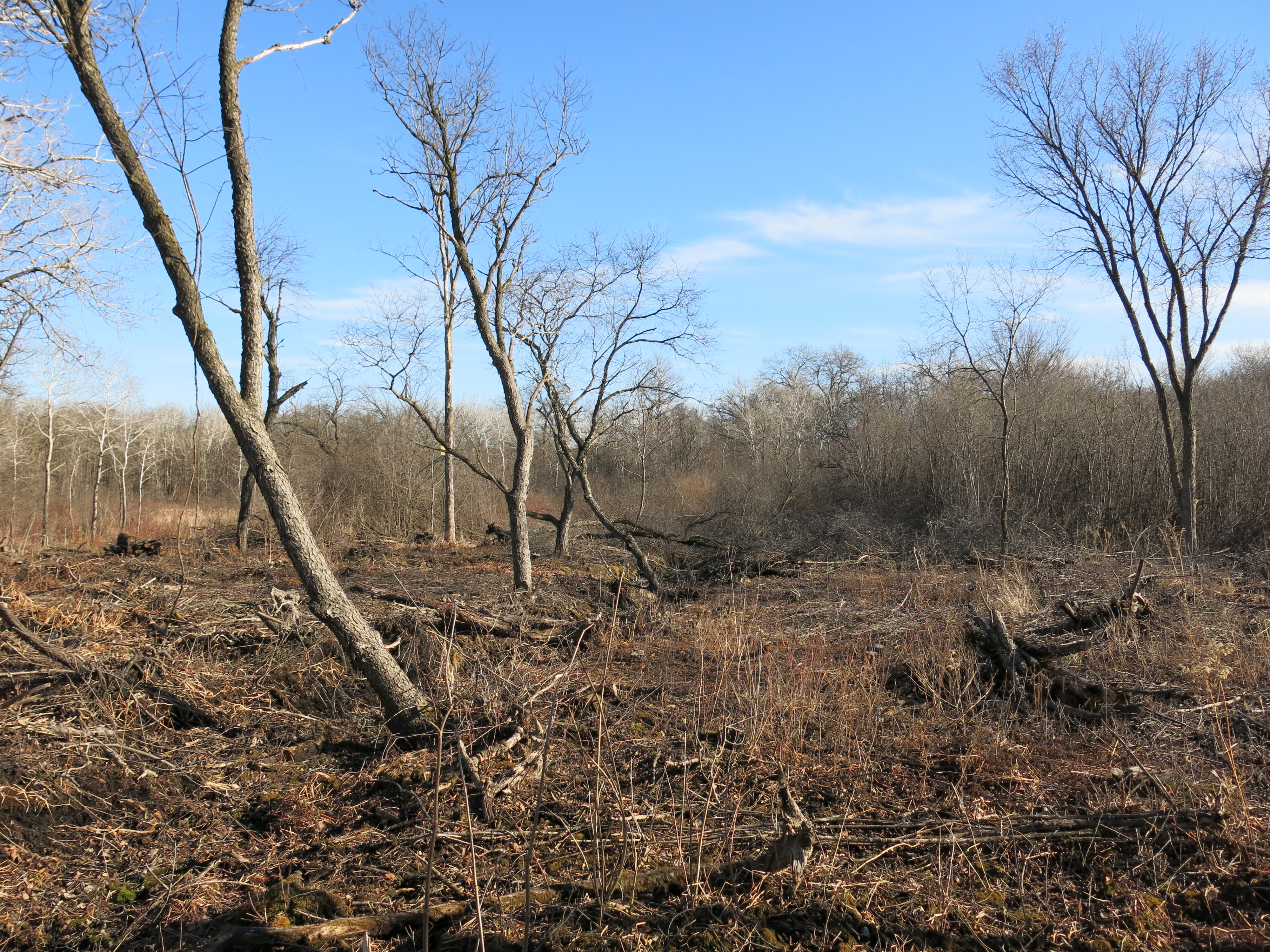
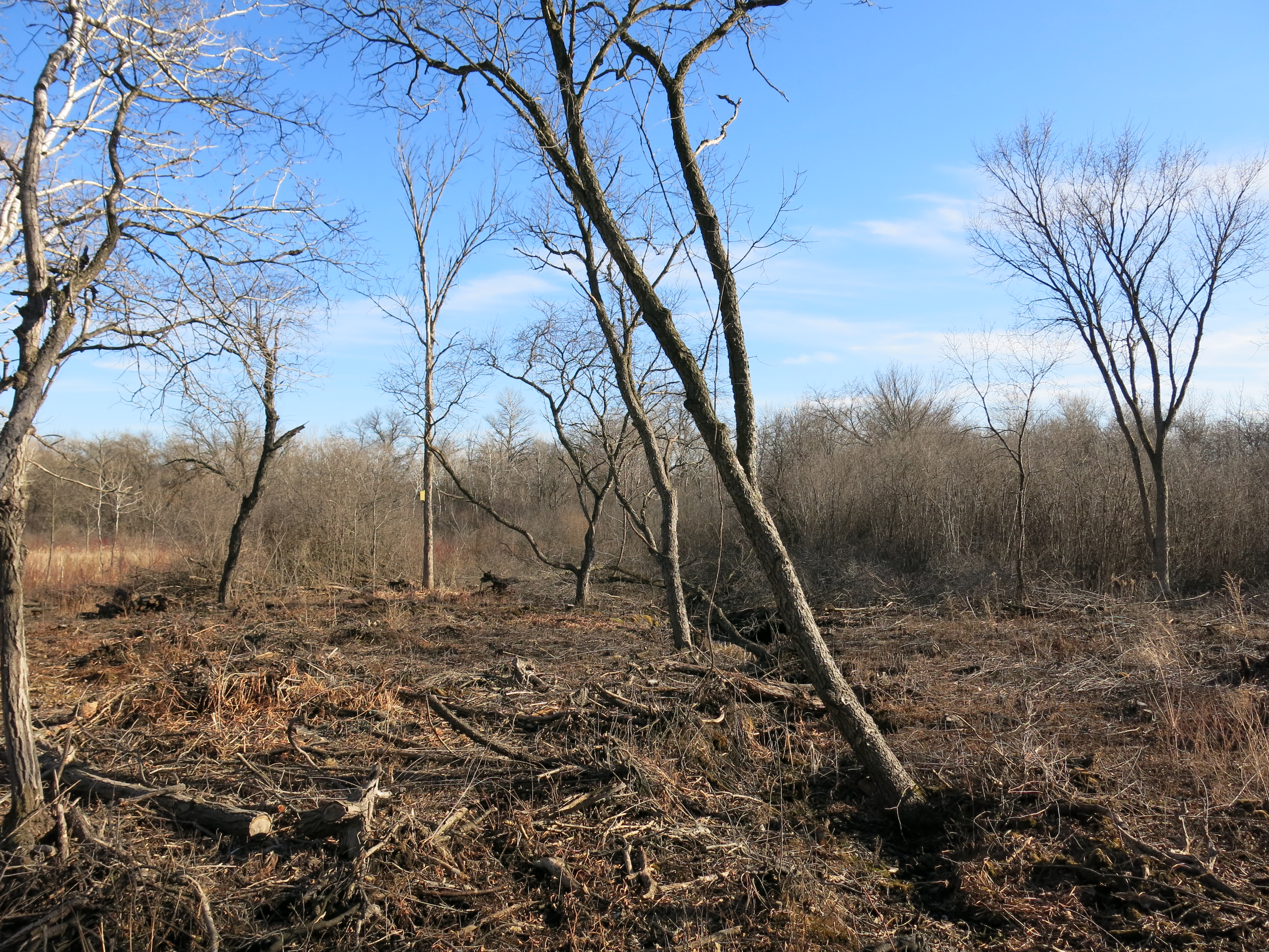
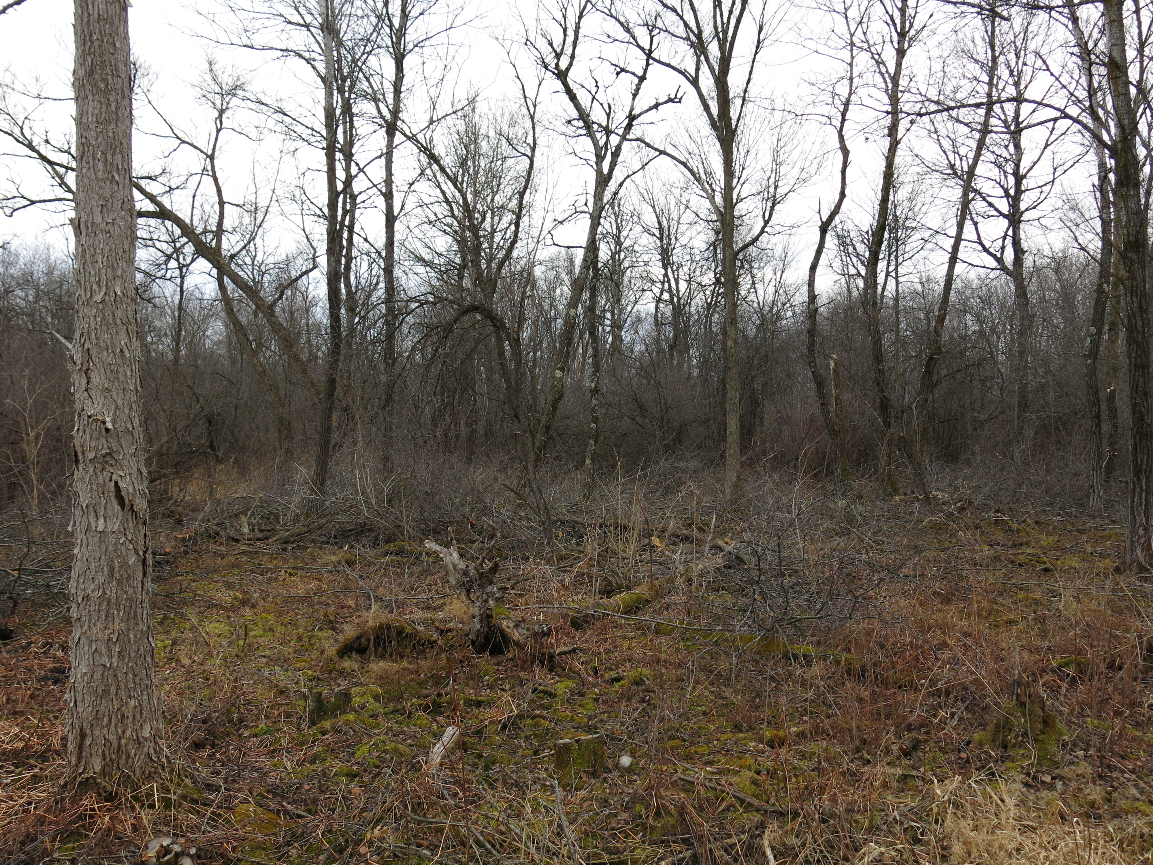
I spent the afternoon at The Springs finishing the last patch of buckthorn near the marl factory that I described above.

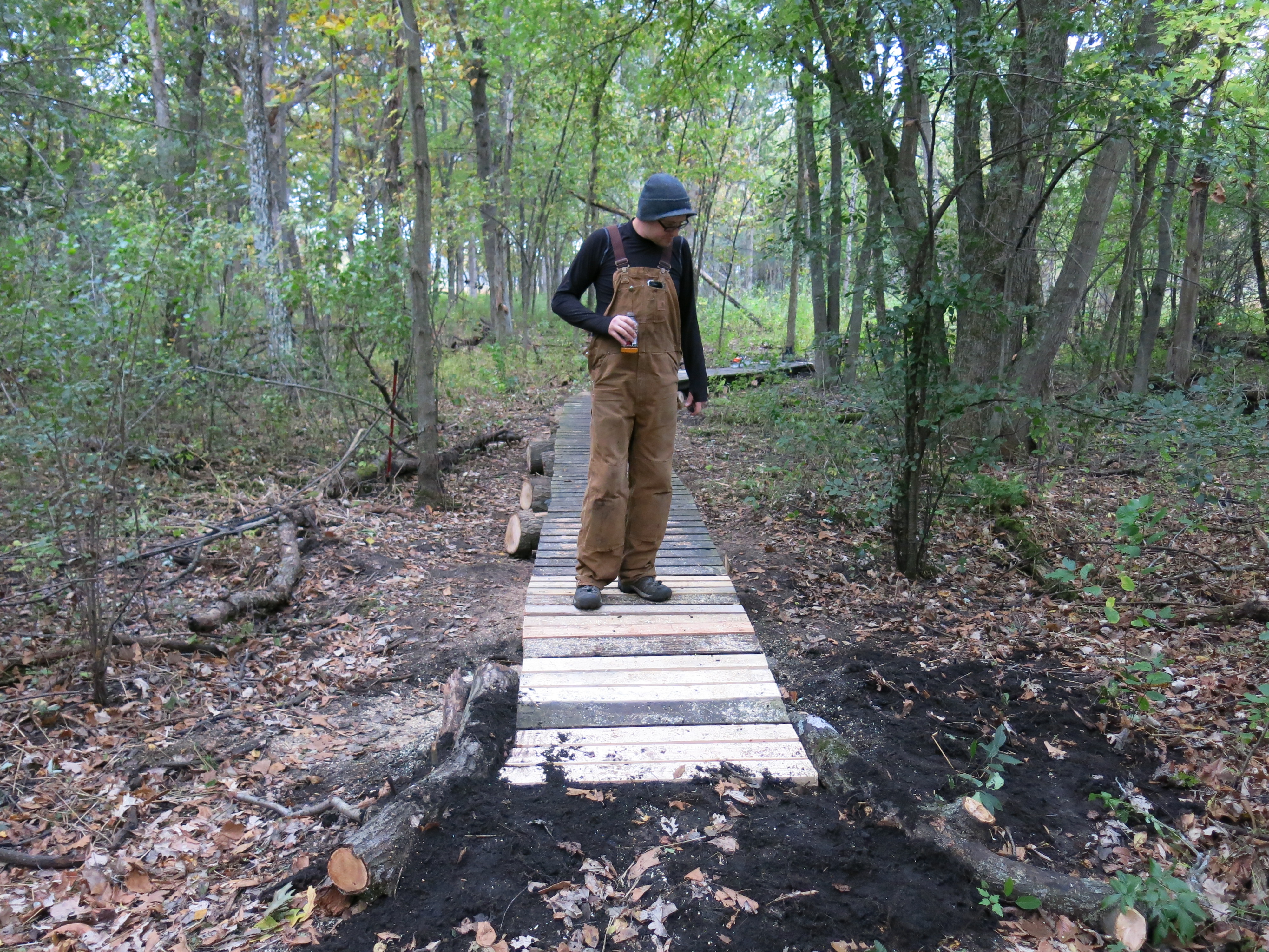
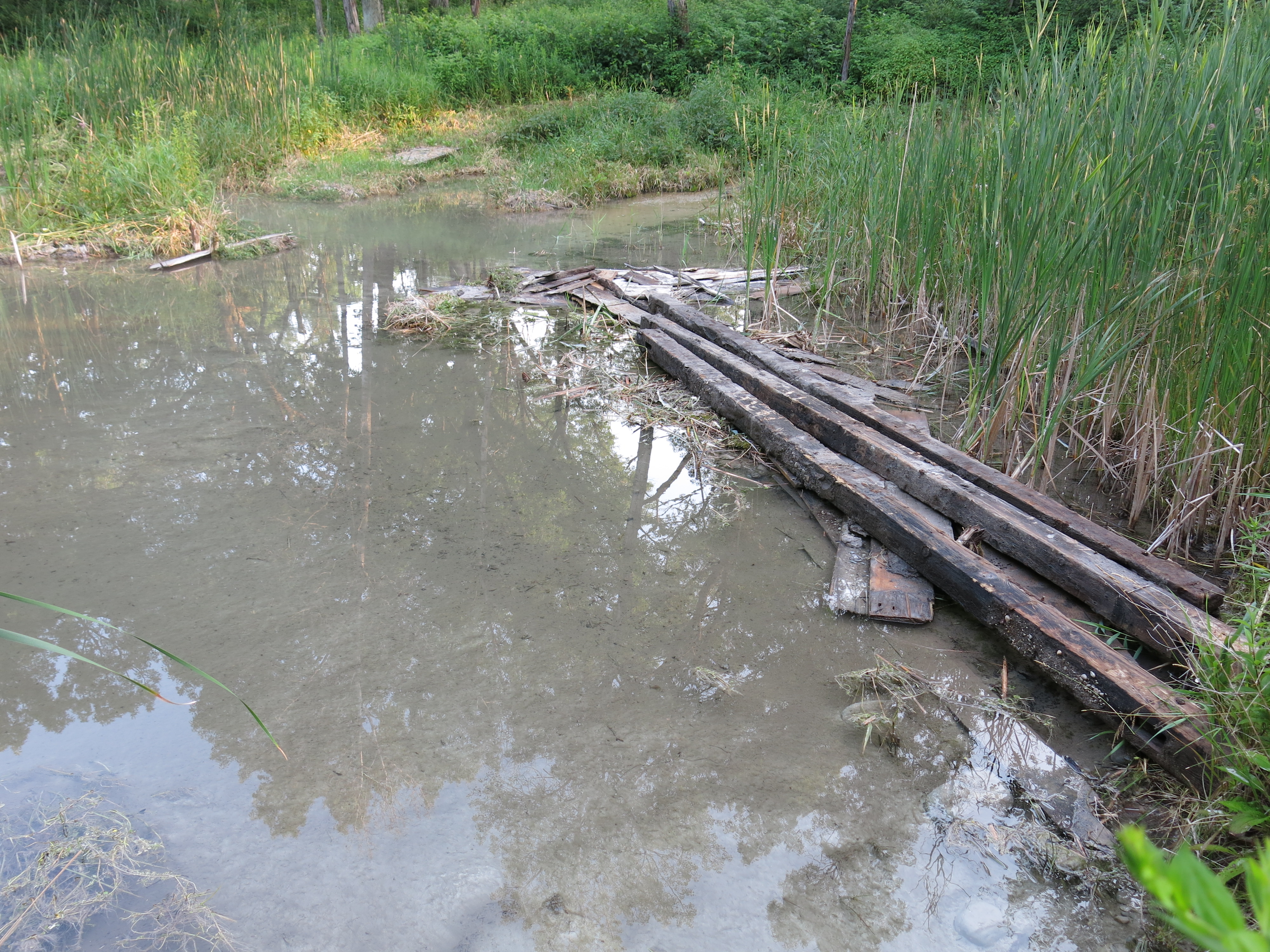
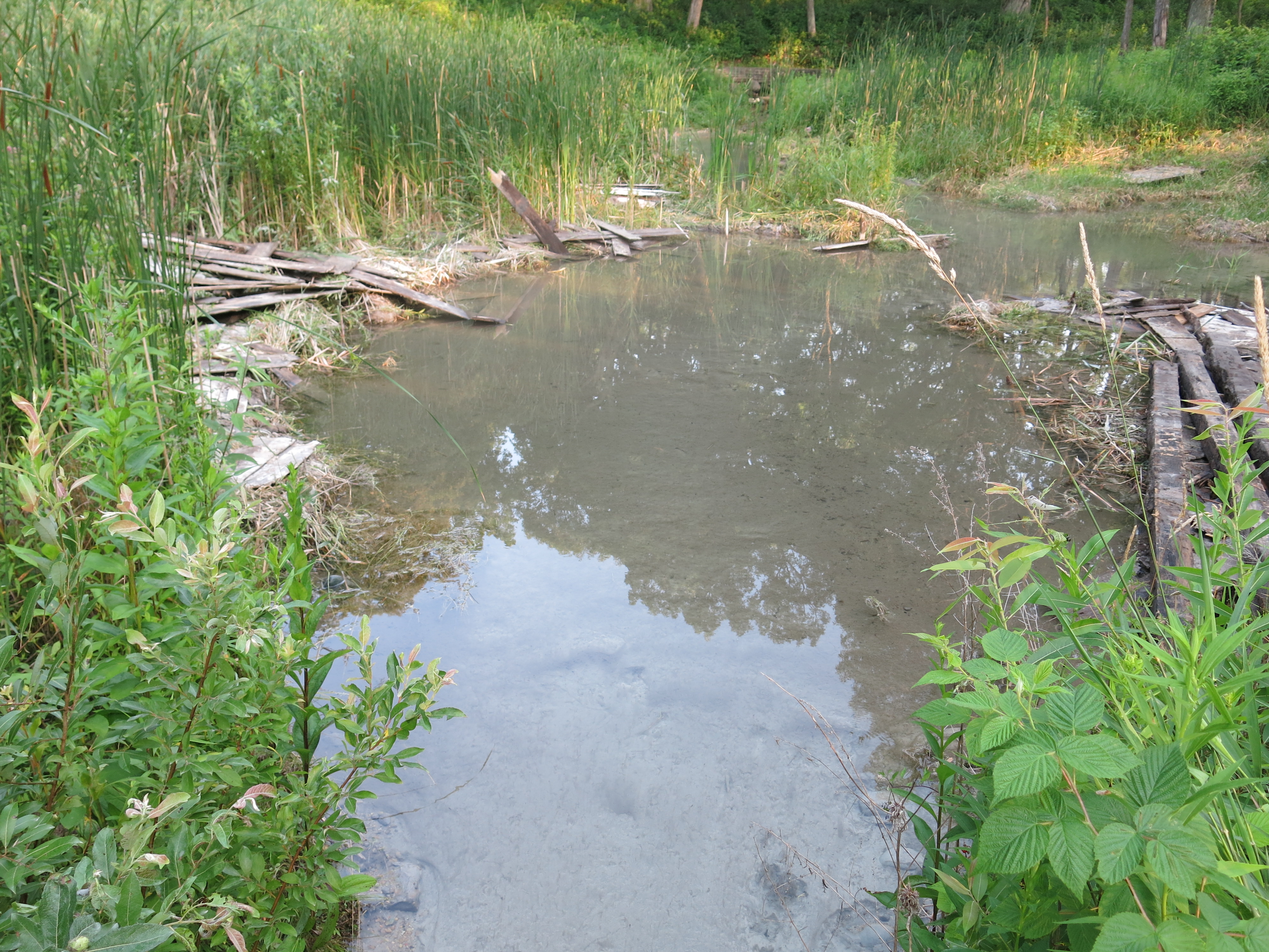
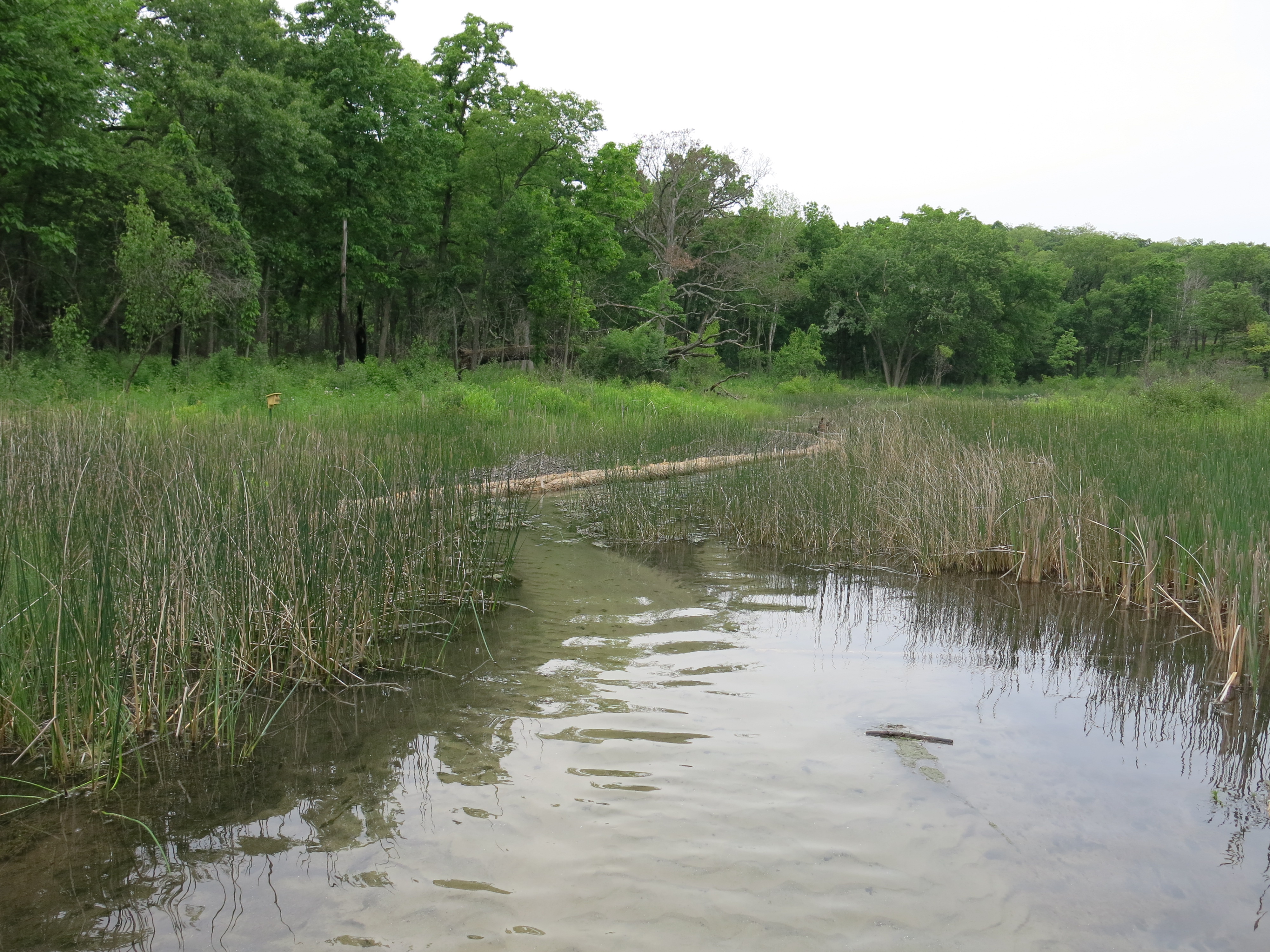
Ben, dude, we gotta fix this boardwalk!

IMG_1761

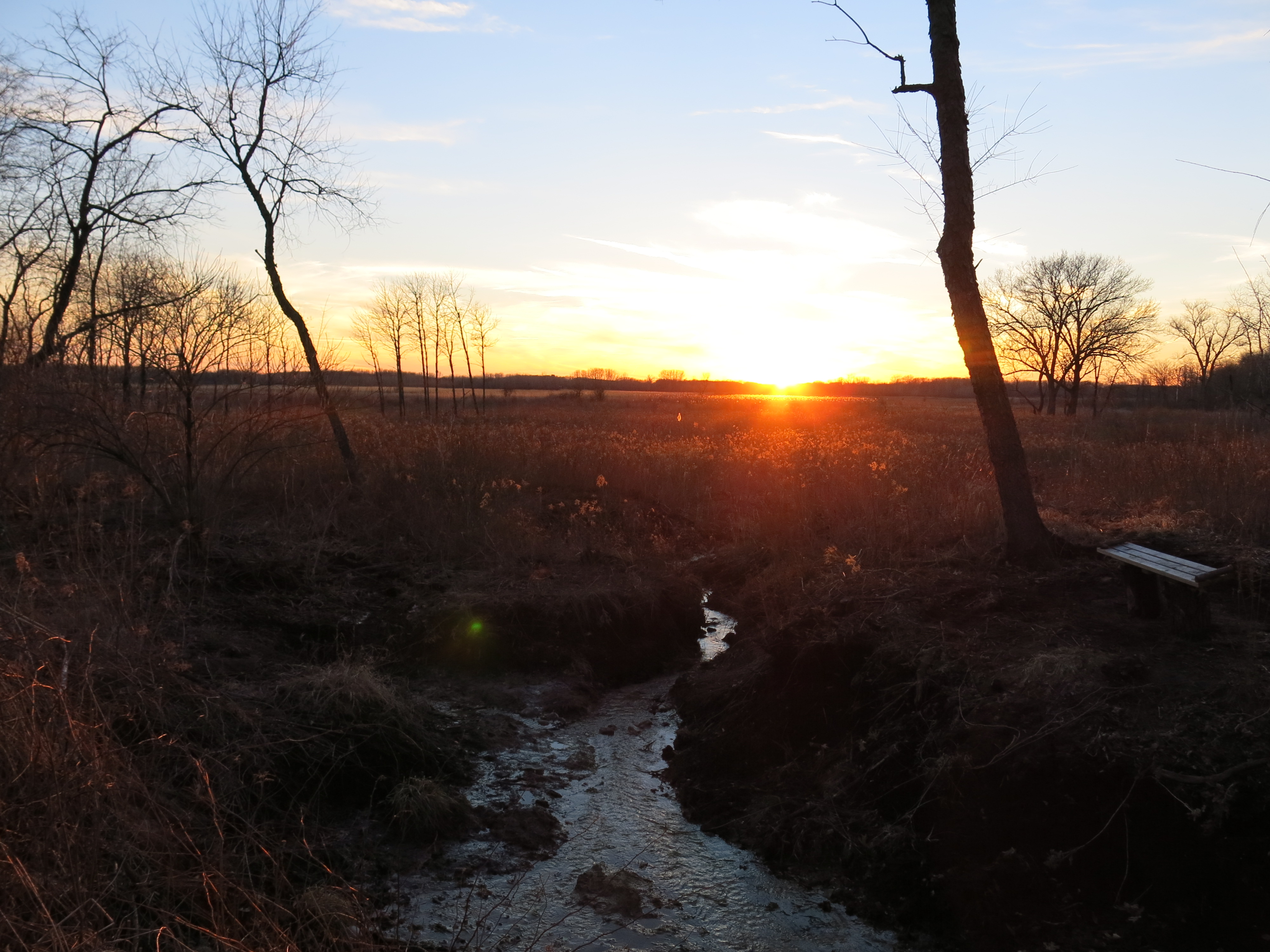
Sunset at the Sand Prairie.

IMG_5299 IMG_5303

On St. Patrick’s day I found evidence that leprecons had visited the springs the night before!

leprecon2

I had NO IDEA they could operate heavy equipment!

IMG_5305 IMG_5307

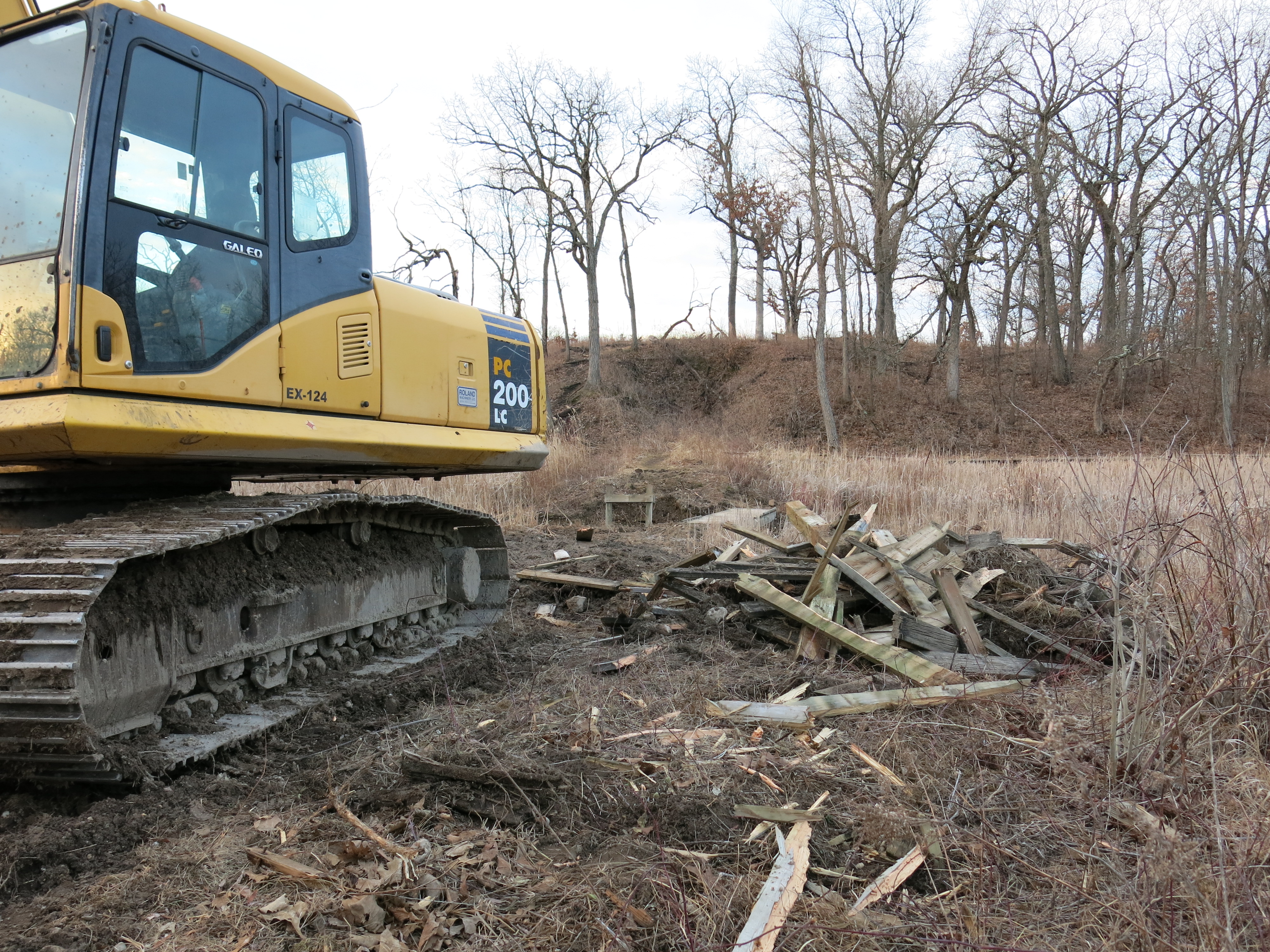
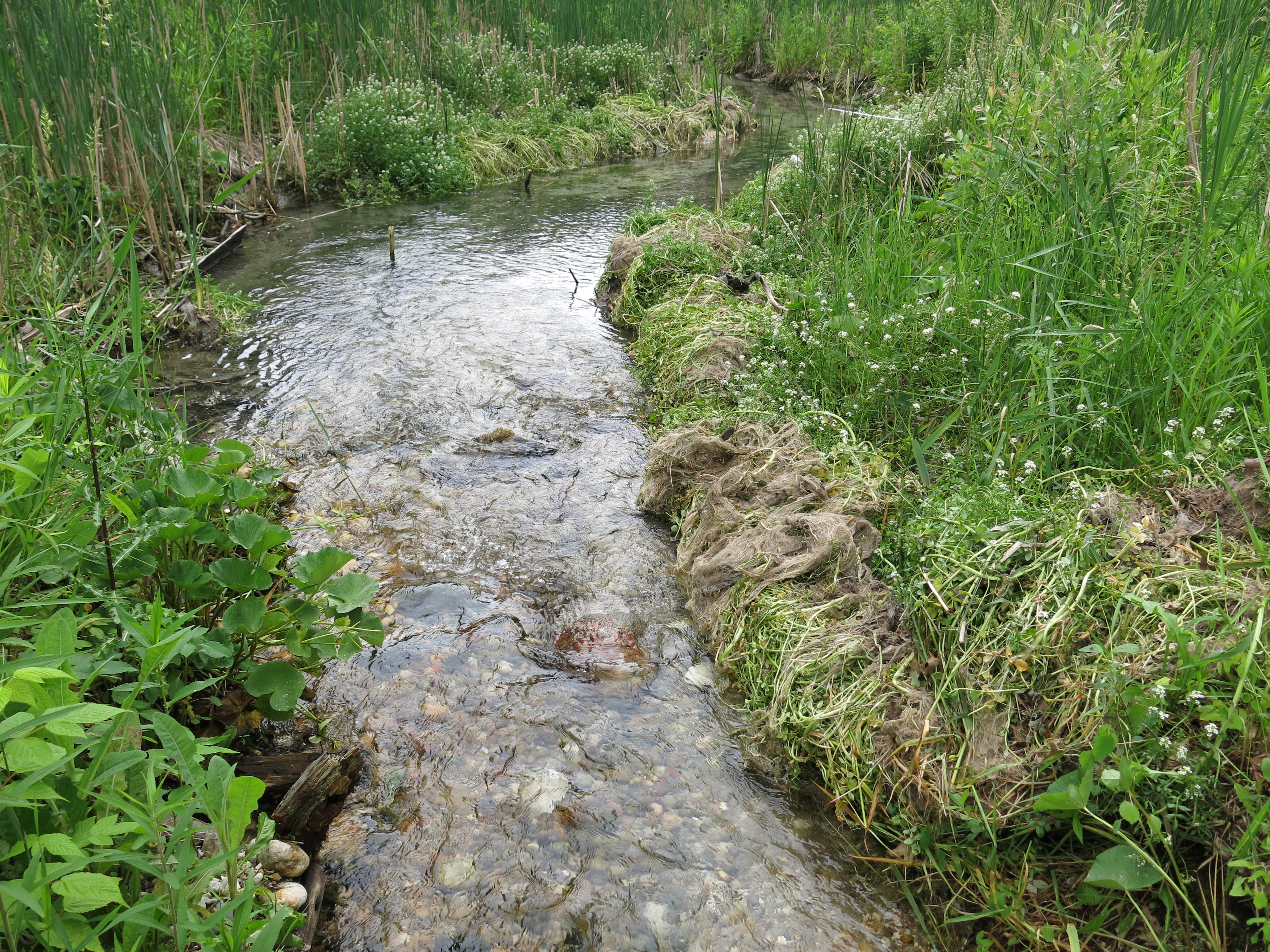
Abe Wittenwyler, heavy equipment operator with the DNR, wasn’t looking for a pot of gold under the Hotel Spring bridge; he had come to excavate the riverbed to address the hydrology issues that Ben Heussner identified as a result of the elevation survey the DNR conducted last year.  I called Ben for an update, left a message, and got to work cutting buckthorn in the wetlands just down the trail — to the left — from the main parking lot on Hwy ZZ.  Here is how it looked before I got started.

IMG_5308

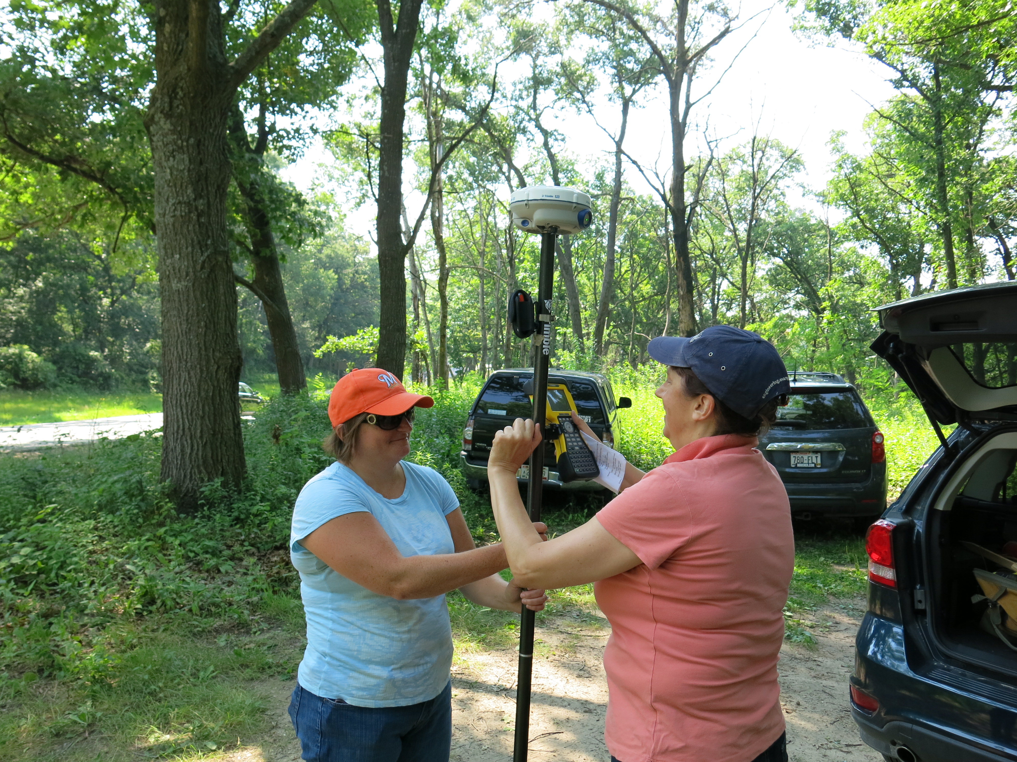
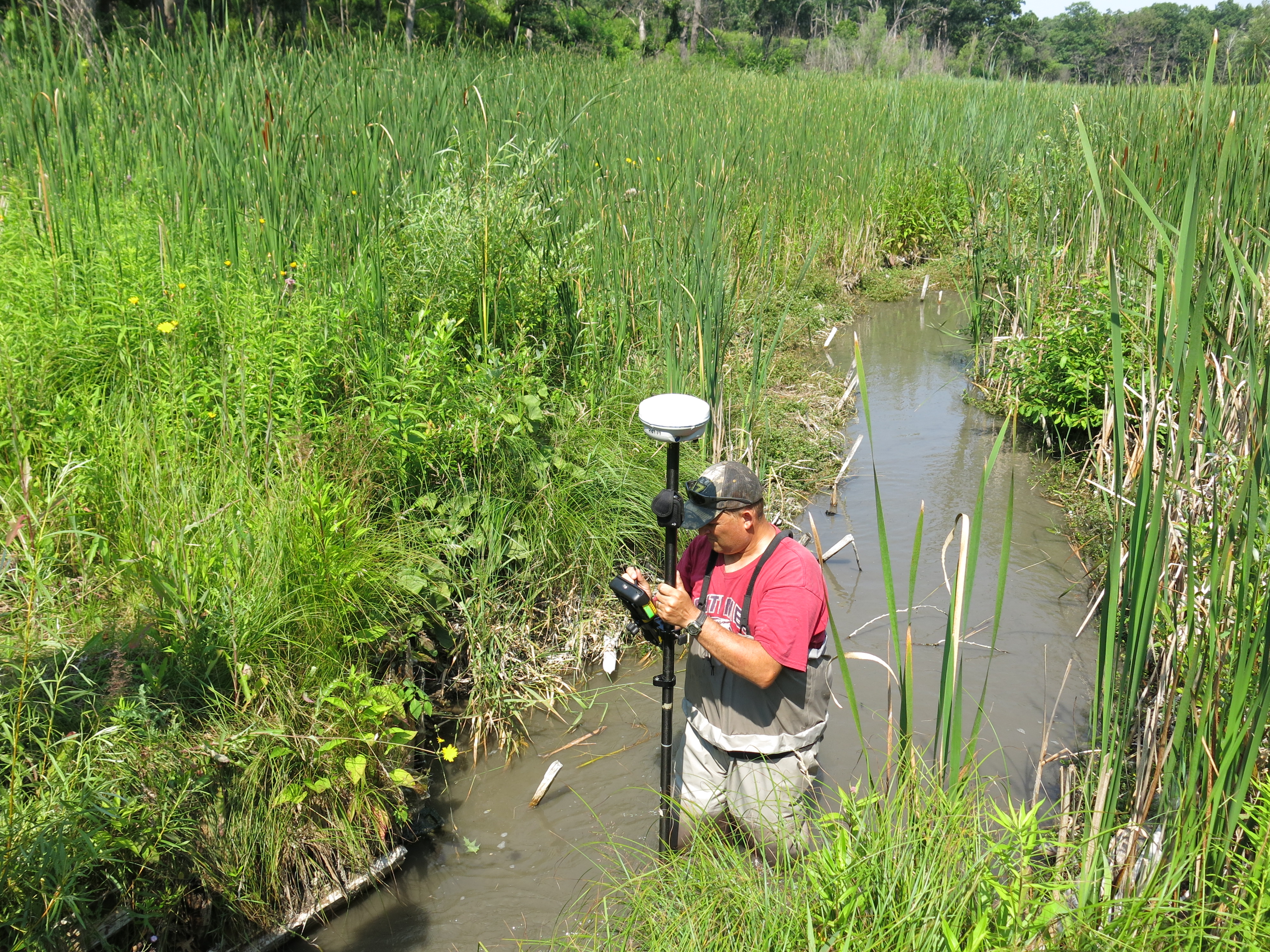
When I broke for lunch, I got Ben’s message and headed over to the Hotel Springs to meet him.  We walked along the river and reviewed the results of our efforts last year while Ben waited for Michelle Hase, DNR Water Regulations and Zoning Engineer, to review the project.

IMG_5314 IMG_5315

Ben Heussner, Steve Gospodarek and Abe Wittenwyler.IMG_5318

Michelle recommended they distribute the “spoils” excavated from the river slightly differently than Ben had in mind.   They regraded the slope on the east side of the river, sowed a crop of annual grass, and then covered the area with straw.  Ben was genuinely proud of the bridge he built there back in 1992 and he’s looking forward to building the replacement this summer.  Me? I’m going to watch the river make a head cut.

IMG_5328 IMG_5329

I returned to my work site and cut buckthorn, like a mischievious leprecon, for the rest of the day.

IMG_5320 IMG_5321

And later visited my favorite haunts.

IMG_5325 IMG_5330 IMG_5334

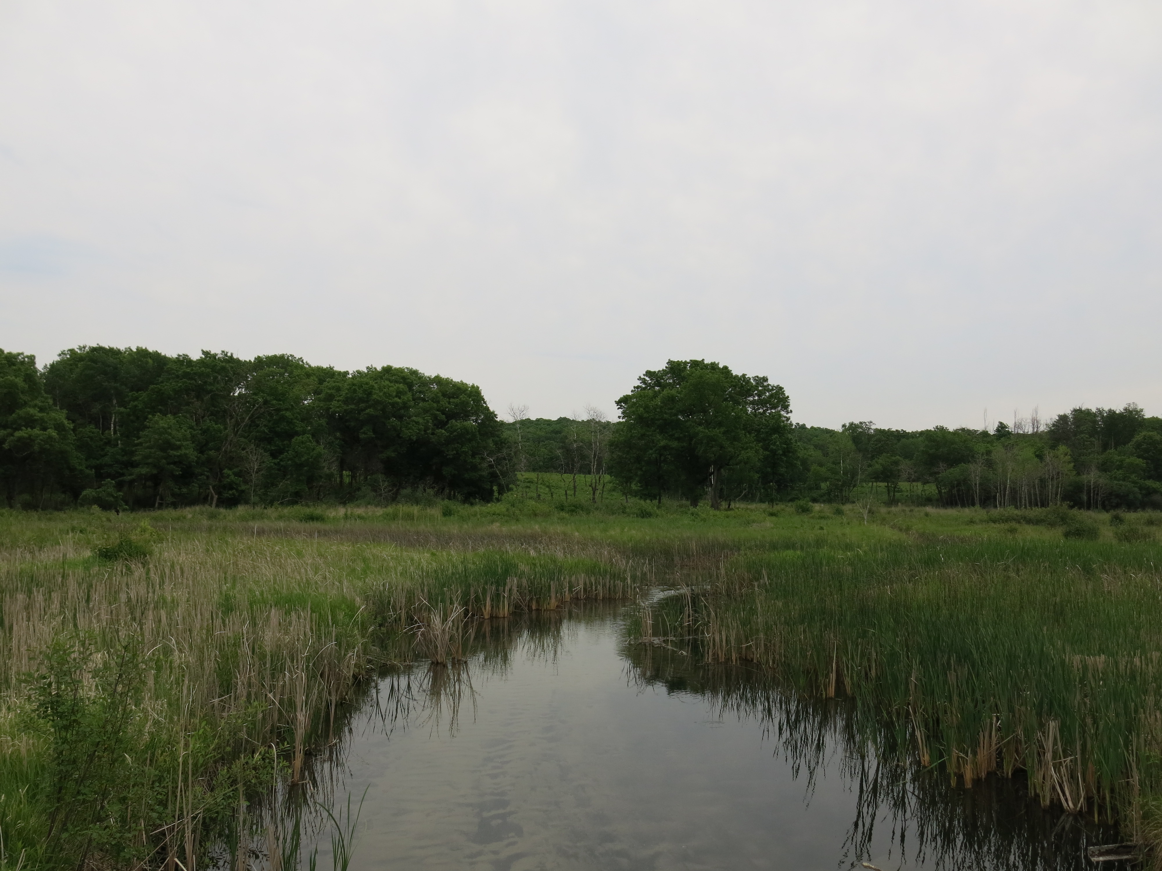
Yesterday I returned to the area and continued to open up dramatic views into, and out of, the very interior of the Scuppernong River Nature Preserve.  I completed clearing the area shown below to totally open the views into the interior wetlands.

IMG_5323 IMG_5324

Then I moved much closer to the parking lot to take on this wall of buckthorn.

IMG_5311 IMG_5312

It was a flawless day and I cut down a hell of a lot of buckthorn.  Views into the interior wetlands are now revealed.

IMG_5340 IMG_5341

And, looking back towards the parking lot, that wall of buckthorn is not so formidable anymore.

IMG_5337 IMG_5338 IMG_5339

I’m going to cut as much buckthorn as I can before the garlic mustard and other weeds start to emerge.

I got my first call of the season from DNR Burn Boss, Don Dane.  Let’s get it on!

See you at The Springs!

p.s. I did not prevail against the agents of the state in court on Friday the 13th.  It ain’t over yet!

Imagining The Scuppernong River

Generation after generation of people lived and loved along the banks of the Scuppernong River.  They never imagined saw mills, cheese factories, trout farms or marl pits; instead, they imagined that the spring waters, diverse prairies and oak savannahs would continue to support them, their children, and their children’s children for generations to come.

When Chester W. Smith arrived in 1847 he imagined the power he could create harnessing the force of the river and he dammed it to make the Buttermilk Mill. His cultural background emphasized man’s mastery over the natural world; it was his oyster!

Talbot Dousman imagined a more sophisticated application of the water in 1874, and he bisected the Scuppernong River with embankments and flumes transforming the headwaters into a trout farm.

The marl works left scabs and a deep scar on the land, wounding and abusing the river during the years it was operated along its banks.

These “care”-takers of the land took more than they cared, leaving the headwaters of the river submerged; its natural course lost under ponds of water for 120 years.

In the early 1990’s DNR Naturalist, Ron Kurowski, and others, imagined the Scuppernong River the way it was before European settlement, and they began reversing the anthropogenic impact via the Scuppernong River Habitat Area restoration project.  What does it mean to imagine the river minus the reckless impacts of those who preceded us?  I think Dr. Megan A.  Styles, Ben Johnson‘s professor at the University of Illinois Springfield, expressed it quite eloquently in a recent email to him:

You’ve hit on a really important central theoretical tenet in restoration ecology — very rarely is the landscape “restored” to a precolonial state; it is actually constructed (notice there’s no “re-” here) anew in a manner that reflects (1) contemporary environmental values and (2) the ways that we “imagine” a truly wild and functional ecosystem should look like. I use the word “imagine” here not to suggest that it is not based in science (it certainly is!), but to remind us that there is a creative process afoot here as well. What we consider a desirable habitat will change over time in concert with changing values and new scientific discoveries.

Ben Heussner and the Wisconsin DNR Fisheries team imagine what a natural and healthy trout habitat should look like and they — one spring at a time, one bend at a time, one tributary at a time — have been reversing the anthropogenic effects on the Scuppernong River watershed for the last 20 years.  Recently they performed an elevation study of the Scuppernong Springs to get the data they needed to objectively support what was visually apparent.

ScuppernongSpringsElevationChange

On a recent visit to The Springs, Ben interpreted the results of the elevation survey and explained their plans for the headwaters:

From the Hotel Spring bridge (site 3 below) we walked upstream along the river bank discussing how the river bed would change as a result of the projected head-cut.  Heussner concluded that the scope of the plan, in addition to the work at the “perch” at the Hotel Spring bridge shown above at data point 1078, should include reducing the humps left after the removal of the embankments where the two bridges lead to the Hillside and Hidden Springs (sites 1 and 2 below), and the hump at the embankment where the mill pond was formed (site 4 below).  He is working now on the permitting process and targeting Spring, 2015, to implement the plan.

ScuppernongRiverElevationWorkSites

Then we walked downstream from the Hotel Spring bridge and inspected the results of the back filling we did last spring to compliment the bio-logs the DNR installed late last year (with help from Trout Unlimited), and imagined what it will look like when these areas fill in with vegetation.  The river is really ripping through this stretch now, creating a sandy, stony bottom and carving deep pools and cut banks; great trout habitat!  Ben is hoping that, with one more workday this December, they can finish the stream bank remediation effort all the way to the gaging station bridge.

Meanwhile, this year, after a long hiatus, the DNR has begun stocking trout again in the Scuppernong River watershed:

  • McKeawn Springs, 37 Brook Trout yearlings
  • Ottawa Lake, 1,485 Rainbow Trout yearlings
  • Paradise Spring Creek, 300 Brook Trout yearlings
  • Paradise Spring Pond, 200 Brook Trout yearlings
  • Scuppernong River at Hwy N, 148 Brook Trout yearlings
  • South Branch Scuppernong River, 74 Brook Trout yearlings.

We are constructing a new reality at the headwaters of the Scuppernong River that reflects: “contemporary environmental values”, and what “a truly wild and functional ecosystem should look like.”

♥ ♥ ♥

Last Thursday I resumed my efforts to prep the Scuppernong Springs Nature Preserve for the next prescribed burn by cutting buckthorn sprouts and seedlings with my brush cutter in the area around the old hotel site.  The new bench that Ben and Karen Johnson built is getting a lot of use!

IMG_4080

I noticed that the black locust removal effort has resumed in earnest.  This is dramatically changing the look of the northeast corner of the property.

IMG_4077 IMG_4078

I also addressed an issue that DNR trail boss, Don Dane, pointed out a while back, and which Dan Carter reiterated on his recent visit, and that is the steep little short-cut trail that was getting “burned in” from the Hotel Spring bridge up to the Sand Prairie.  Here are before…

IMG_4083

… and after images.

IMG_4085 IMG_4086

Ben Johnson joined me after work and we harvested some red oak logs that we planned to use to raise a boardwalk at the east end of the Buckthorn Alley.

IMG_4087

We cut up the downed tree on the left shown above and moved the logs over to the boardwalk with a hand dolly.

IMG_4089

On Friday I strapped on the brush cutter and did some “mowing” along the cut-off trail.  Although it looks like a carpet of buckthorn, there was a lot of wild strawberry and geranium actively growing at ground level and I was glad I wasn’t spraying herbicide.

IMG_4092 IMG_4093

Later, I checked out the results of the latest hand-to-hand combat with the black locust.  I’ll go out on a limb and say this is the handiwork of Steve Tabat and his crew, although I have not seen them personally in action.

IMG_4094

On Sunday, Ben Johnson and I began an ambitious boardwalk raising effort.

IMG_4097 IMG_4098

In a couple hours we had the deck torn apart.  You can see how it was embedded in the dirt.

IMG_4100 IMG_4101

IMG_4102

It took a while to get going and determine the best, complimentary, way to use our skills, but soon the new boardwalk was taking shape.

IMG_4104 IMG_4105

It was fabulously busy and we were constantly interrupted by hikers; good thing Ben posted a couple of orange, “trail work ahead”, cones to warn them.

Did I mention that Ben is indefatigable?

IMG_4106 IMG_4108 IMG_4109

Thanks again Ben for leading this effort!

It was an epic week at The Springs and I hope to see you there soon!

Scuppernong River Survey

Like the headwaters of the river itself, efforts to restore the Scuppernong River to its natural state are gaining momentum.

Late last Fall the DNR Fisheries team, along with help from Southeast Wisconsin Trout Unlimited, installed bio-logs on the stretch of river between the old barn site and the gaging station bridge.

IMG_1420

This Spring, we filled in the areas behind the bio-logs with brush inspired by the efforts of volunteers from Trinity United Methodist Church.

IMG_3150

And recently, we rolled back the water cress…

IMG_3318

… and began removing the remaining structures from the flumes that once channeled the outflow from the Scuppernong Spring.

IMG_1363

The last time we saw Ben Heussner, DNR Fisheries Biologist, at The Springs, I reviewed with him the fact that in most of the places where dams or levees previously blocked the river, it looked like not enough of the obstructing material was removed, which resulted in humps in the riverbed that caused silt and marl to collect upstream.  Ben agreed and commissioned an elevation survey of the river from the Scuppernong Spring all the way downstream to the Marl Pit Bridge.

ScuppernongRiverSurvey

  1. Scuppernong Spring
  2. First bridge — end of flumes
  3. Second bridge — leading to hillside and hidden springs
  4. Emerald Spring
  5. Hotel Spring Bridge
  6. Hotel Spring
  7. Old Barn site
  8. Mid-point between old barn site and Gaging Station Bridge
  9. Gaging Station Bridge
  10. Just upstream of Marl Pit Bridge
  11. Marl Pit Bridge

Ben assembled a team of DNR experts to do the job.

IMG_3446

From left to right above: Michelle Hase — Water Regulations and Zoning Engineer, Andrew Notbohm — Fisheries Technician & Water Resources Management Specialist, Lynette Check  — NR Engineer, Steven Gospodarek — Fisheries Technician and Joshua Krall — Fisheries Technician.  What a fine group!   I had a blast tagging along and listening in.

In locations where there was a noticeable hump in the riverbed, like points 2, 3, 5 and 10 marked on the river image above, they captured three GPS points: one at the “toe”, or point upstream where the hump started, one at the middle of the hump, and one at the “heel”, or point downstream where the hump ended.  Using the elevations from these three points and calculating the desired, or optimal slope, by incorporating all of the data point elevations, they will be able to determine how much material should be removed from the hump to allow the river to clear out the accumulated sediment.  Steve and Michelle explained that this doesn’t necessarily mean removing material from the river, it may be enough to simply spread the hump out beyond the “toe” and “heel”.

Lynette is the expert with the Trimble, GPS device and she made sure we accurately captured all the data points.  Back at the office, she will retrieve the exact elevations of each location and map them out.  There are simple and sophisticated ways to present the results depending on the questions asked, and I’m looking forward to the recommendations the DNR Fisheries Team comes up with.

Lynette and Michelle putting the trimble together.

IMG_3432

The device relies on a cell phone to upload the data and Lynette took a soaker for The State, to help Steve reinitialize the device at the Scuppernong Spring.

IMG_3438

Steve “Gus” Gospodarek taking the measurement at the “heel” downstream of the bridge at location #3 shown above.

IMG_3441

Capturing the data point at the Hotel Spring.

IMG_3442

Big birds at the Big Bend.

IMG_3444

I was in heaven the whole time and thoroughly enjoyed the experience.  Steve taught me new words like thalweg

ThalwegDiag

… and oligotrophic.  Although the term oligotrophic (Lacking in plant nutrients and having a large amount of dissolved oxygen throughout) is normally applied to lakes, the concept can be extended to rivers as Steve used it to describe the Scuppernong River.

When the survey was done, Steve suggested we go back to forest headquarters and pick up a “jetter pump” to blast out the muck encasing the huge oak beams we discovered under the wreckage of the old flumes.  It was a pleasure to visit the Fishery Team’s storage facility and watch Steve, Andrew and Josh whip together a jetter pump rig.  Before you could say “brook trout”, we were back at the Scuppernong Spring blasting beams out of the muck.

IMG_3447

I had so much fun…

We got three beams totally out and almost finished a fourth.  Josh suggested we leave a beam that we half excavated in place to create a bend in the channel — and so we did.  The views below are looking upstream from the first bridge below the Scuppernong Spring, where the flumes ended.

IMG_3453 IMG_3452

I have the jetter pump rig in my truck and hopefully we’ll be able to get the remaining beams out in the next few weeks.

It was an excellent day capped off when Pati, my African Queen, came out to join me and say goodbye to the Scuppernong Springs before she embarks for South Africa again.

IMG_3457

See you at The Springs!


Group Trout Stream Therapy

When DNR Fisheries Biologist, Ben Heussner, contacted me last week about a workday on the Scuppernong River, I didn’t dare to imagine the fantastic outcome we would realize yesterday.  “Fix the water“, that’s what Tracy Hames, executive director of the Wisconsin Wetlands Association,  preaches and we put that mantra into action with a Group Trout Stream Therapy session.

Ben set the table last December with 2 workdays on the river where the DNR fisheries team, along with help from Southeast Wisconsin Trout Unlimited, installed dozens of coconut hull biologs to re-establish the river’s natural meander.  Then Mike, a trout unlimited volunteer from Wilmette, IL, and Ben coordinated to bring a group of volunteers from Trinity United Methodist Church up to help us fill in the wet areas behind the biologs.  I can say unequivocally that this was the hardest working team of volunteers I have ever had the pleasure to work with. They were filled with the spirit for sure!

IMG_3134

Above that is Ben Heussner, Pastor Brian Smith, Donna McCluskey, Bob Meyers, Sarah Jacobs, Ella and Elliot Torres, Carol Meynen, Tom Board, Ward Reeves and Mike Jacobs seated in front.

Ben Heussner met Ben Johnson, Dick Jenks and myself to scope out the situation and plan the day’s work.

IMG_3132

He is a very busy dude, and shortly after he introduced us to the group from Trinity United Methodist, we were on our own.  It didn’t take long to establish a system to deliver the aspen I had cut to the locations on the river where it was needed.

IMG_3136

Our first site was the major westbound bend in the river, where we constructed a V-shaped wedge to define a single stream channel.

IMG_3137

We were literally on a roll and the team from Trinity was not shy about getting wet and dirty, which ironically, I found very refreshing.

IMG_3139

Rolling, Rolling, Rolling On A River!

IMG_3142

Thank you, thank you!  Look what you accomplished.  The views below begin at the first site we worked and proceed downstream.

IMG_3150 IMG_3151 IMG_3152 IMG_3153 IMG_3154 IMG_3155 IMG_3156 IMG_3157 IMG_3158 IMG_3159

We hope to work with volunteers from Trinity United Methodist again.  What a great group!

On our way to take a walk up the river and inspect our work, Ben Johnson and I ran into this sand hill crane and chick, who were also checking it out.

IMG_3145 IMG_3147

This is the point downstream of the recent activity where sand and marl is collecting after being flushed down the river.

IMG_3148

We continued to walk upstream and review the day’s work.

The meadow on the south side (right side in the video above) is especially lush with native plants and flowers.

IMG_3160 IMG_3162 IMG_3077

Ben and I agreed that the velocity of the river had definitely increased as a result of the work.  Confirmation bias?

IMG_3163

We’re not done yet!  Ben Heussner will be back in the next couple weeks to do an elevation survey of the area around the hotel springs bridge.  He is confident that, with a little excavation of the river bottom here, we can get a headcut traveling.  This will flush out the marl and sand that collected in the riverbed upstream, while it was under it was under THE PONDS OF THE SCUPPERNONG.  The result will be significantly improved trout habitat and restoration of the headwaters to its natural condition.  I can’t wait!

IMG_3165

See you at The Springs!